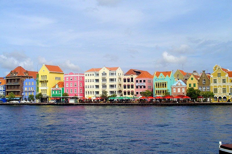
 Willemstad waterfront in Willemstad, Curaçao
Source: https://commons.wikimedia.org/wiki/File:Handelskade_Willemstad.jpg
Author: Rodry

Curaçao is an independent island nation in the southern Caribbean, off the coast of Venezuela. It is one of the ABC islands which include Aruba and Bonaire. Curaçao covers 444 sq km (171.4 sq mi) and has a population of 142,000 (2011 estimate). it includes the small, uninhabited Klein Curaçao. Together Curaçao is a constituent country within the Kingdom of the Netherlands. The capital and largest city in Curaçao is Willemstad.
Curaçao is four hours behind Coordinated Universal Time (UTC-4). It uses the Netherlands Antillean guider as its official currency. Traffic is driven on the right, the same as in the Netherlands. The phone IDD code is +599-9. The electricity here is 110-130V/50Hz using European plug. The official languages are Papiamentu and Dutch.
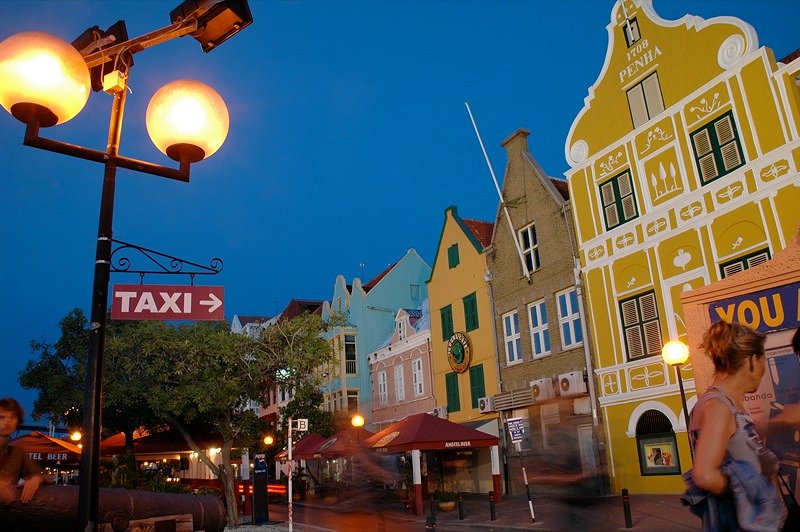
 Evening in Willemstad, Curaçao
Source: https://commons.wikimedia.org/wiki/File:WillemstadEvening.jpg
Author: Chika Watanabe

The name Curaçao means "cured" in Portuguese. How this name came about has not been fully established, with popular opinion being that it was given by early Portuguese who were cured of scurvy. In 16th century Spanish maps, the island appears as Curaçote, Curasaote and Curasaore.
Curaçao was occupied by the Dutch since 1634. The Dutch West Indies Company founded the settlement of Willemstad, which is today the capital, in 1634. Interestingly, although being under the Dutch for over four hundred years, the island was not renamed to a more Dutch-sounding one.
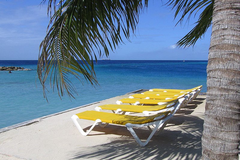
 The gorgeous seaside in Curaçao
Source: https://commons.wikimedia.org/wiki/File:Beach_view_Curacao.jpg
Author: Acdx

As with the other islands of the Caribbean, Curaçao is now banking on tourism as the mainstay of its economy. To this, it promotes its beaches and heritage as tourist products. In 2009, it had an estimated GDP at purchasing power parity of $2.914 million, equivalent to a per capita GDP of $20,567.
Curaçao has a semiarid climate which provides lots of sunshine attractive to most sun-seeking tourists. The temperature is quite uniform across the year, between 25.6°C (78/1°F) and 31.2°C (88.2°F). The dry season here is from January to September while the wet season from October to December.
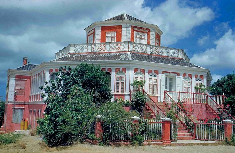
 Building called Landhuis Groot Davelaar in Curaçao
Source: https://commons.wikimedia.org/wiki/File:Landhuis_Groot_Davelaar_Cura%C3%A7ao.jpg
Author: Harry van der Made

Planning your visit to Curaçao
Hato International Airport (CUR) on the northern part of Curaçao is the gateway to the island. It receives flights from Amsterdam, Aruba, Bogotá, Bonaire, Caracas, Miami, Newark, Panama City, Paramaribo, Port of Spain and Santo Domingo, among others.To explore Curaçao, it's best that you rent a car. There are a number of car rental agencies at the airport. The fee is around $45 per day.
Major Cities in Curaçao
- Willemstad - capital
Places of Interest in Curaçao
- Christoffel National Park
- Curaçao Sea Aquarium
- Fort Amsterdam
- Fort Nassau
- Hato Caves
- Maritime Museum
- Mikvé Israel-Emanuel Synagogue
- Museum Kura Hulanda
- Postal Museum
- Queen Emma Bridge
- Queen Juliana Bridge
- Shete Boka National Park
Beaches in Curaçao
- Cas Abao
- Daaibooi Baai
- Habitat Beach
- Playa Grote Kenapa
- Playa Jeremi
- Playa Kalki
- Playa Kleine Kenapa
- Playa Lagun
- Playa Porto Mari
 Latest updates on Penang Travel Tips
 Discover with Timothy YouTube Channel
 PG Food Channel
 Learn Penang Hokkien YouTube Channel
 SojiMart Videos
Latest from Discover with Timothy: Gurney Bay - what to see and do there
About this website

Hello and thanks for reading this page. My name is Timothy and my hobby is in describing places so that I can share the information with the general public. My website has become the go to site for a lot of people including students, teachers, journalists, etc. whenever they seek information on places, particularly those in Malaysia and Singapore. I have been doing this since 5 January 2003, for over twenty years already. You can read about me at Discover Timothy. By now I have compiled information on thousands of places, mostly in Peninsular Malaysia and Singapore, and I continue to add more almost every day. My goal is to describe every street in every town in Malaysia and Singapore.
Robbie's Roadmap
- Episode 1: Robbie's Journey to Financial Freedom
- Episode 2: Lost in America
- Episode 3: The Value of Money
- Episode 4: The Mentor
- Episode 5: The Thing that Makes Money
- Episode 6: The walk with a Billionaire
- Episode 7: The Financial Freedom Awakening
- Episode 8: Meet Mr Washington
- Episode 9: The Pizzeria Incident
Copyright © 2003-2024 Timothy Tye. All Rights Reserved.


 Go Back