
Changsha 长沙
 Go Back - Latest PENANG Sights/Streets/New Properties > Malaysia > World | Hokkien : Lessons : Dictionary | YouTube | Facebook | About Me : Contact Me
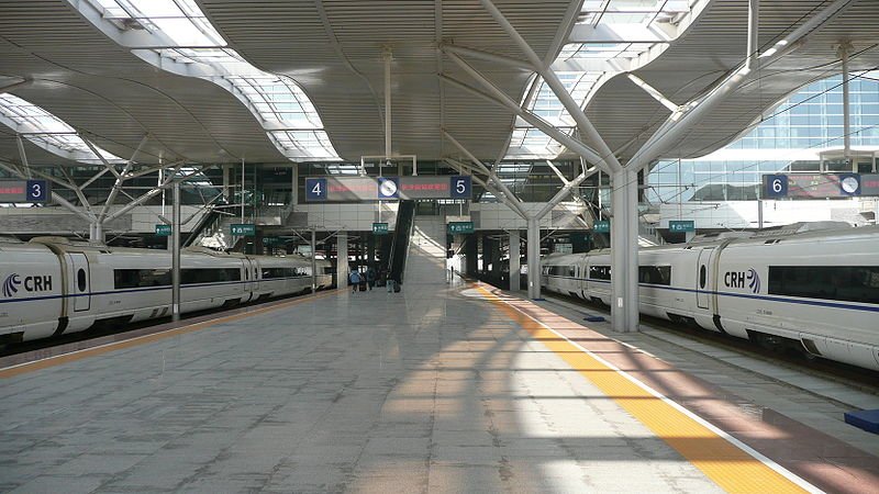
 Changsha South Railway Station
Source: https://commons.wikimedia.org/wiki/File:Changsha_South_Railway_Station_10.JPG
Author: Brücke-Osteuropa

Changsha (长沙) is the capital and biggest city in Hunan Province, China. The municipality of Changsa covers 11,819 sq km (4,563.3 sq mi) and has a population of 6.6 million people. The urban center of Changsha has a population of 2.7 million people.
Changsha straddles the Xiang River, a branch of the Yangtze River. The city experiences a humid subtropical climate. The warmest month here are July and August, when the temperature regularly exceeds 33°C (92°F). Coldest month is January, when temperature drops to 1.6°C (34.9°F). April is the wettest month, with 207 mm (8.2 in) of precipitation.
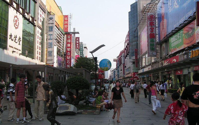
 Huangxing Road, Changsha
Source: https://commons.wikimedia.org/wiki/File:Huangxing_road_in_Changsha.jpg
Author: Juansheng, Shizhao

The history of Changsha goes back to as early as the 1st millennium BC, when it was a settlement in the State of Chu. During Han Dynasty, it was already a capital of its namesake Changsha Kingdom. Changsha was made the capital of Hunan Province in 1664. Its economy was fueled by it being a major rice market.
The development of Changsha in the early 20th century can be attributed to railway links connecting it to Hankou in Hubei Province in 1918, from where the line extended to Guangzhou in Guangdong Province in 1936. Until 1937, the city depended mainly on trade, as it had not yet developed an industrial base. Its industrialization in the later part of the 20th century has enabled it to expand rapidly, tripling its population from 1949 to 1980.
The most famous person to be associated with Changsha is Mao Zedong. Between 1913 and 1918 he was a student at the Hunan No. 1 Teachers' Training College, where he would return later as a teacher and principal from 1920 to 1922. The college, which was destroyed during the Chinese Civil War, is now rebuilt, and now showcases memorabilia associated with Chairman Mao.
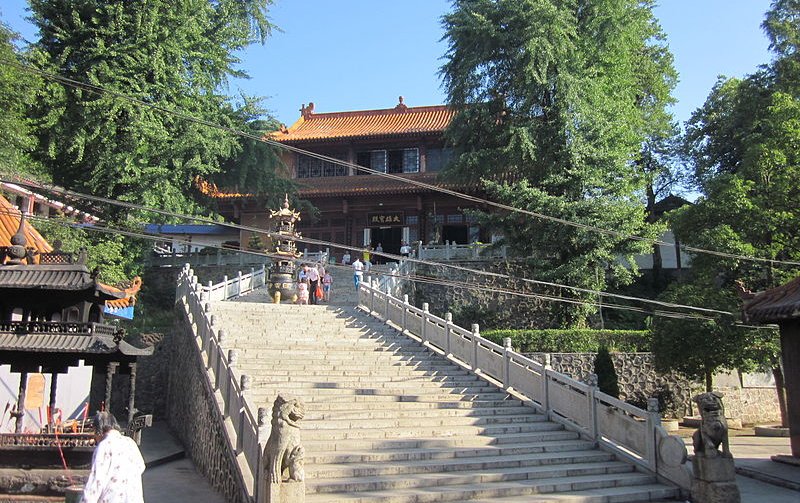
 Bai Yun Temple, Changsha
Source: https://commons.wikimedia.org/wiki/File:Bai_Yun_Temple_43.JPG
Author: Huangdan2060

Changsha is a major economic center for industries such as rice, cotton, timber and livestock. It is also a major power producer with a large thermal generating station. In the past decade, it had managed to attract billions of dollars in foreign direct investment. In 2008, Changsha had a nominal GDP of ¥300.1 billion (US$43 billion), equivalent to a per capita nominal GDP of ¥45,765 (US$6,589).
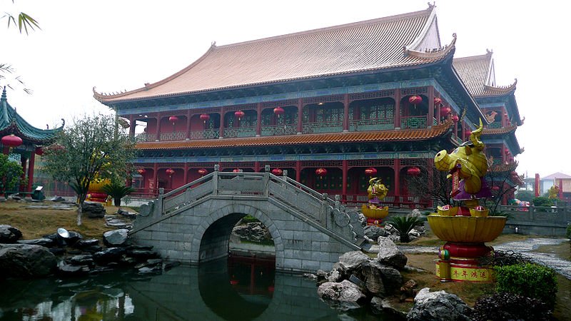
Changsha is today one of the top 20 economically advanced cities of China with a sizable middle class population. The city has the biggest Chinese restaurant in the world. Called the Xihulou, it has 4,000 seats. However its rapid growth comes with a high price, as the city now has to deal with environmental pollution and degradation.
Planning your trip to Changsha
The Changsha Huanghua International Airport (CSX) is located 20 km to the east of downtown Changsha. It is the main civilian airport for Hunan Province. The airport receives flights from major cities across China as well as from Hong Kong, Seoul and Taipei. Arriving at the airport, you can take the airport bus to downtown Changsha. The fare is ¥16.50 and the journey takes about 50 minutes. Xihulou Chinese Restaurant, Changsha
Source: https://commons.wikimedia.org/wiki/File:Xihulou_15.JPG
Author: Brücke-Osteuropa

Exploring Changsha
The most practical way to go from place to place in Changsha, for a visitor, is to take the taxi. If you do not speak Chinese, have your destination written for you by your hotel, and make sure you keep a hotel name card to show the driver, for your return trip. The taxi fare starts at ¥6.00.Places of Interest in Changsha
- Hunan No. 1 Teacher's Training College
- Hunan Provincial Museum
- Hunan University
- Martyrs' Park
- Xihulou Chinese Restaurant
 Latest updates on Penang Travel Tips
 Discover with Timothy YouTube Channel
 PG Food Channel
 Learn Penang Hokkien YouTube Channel
 SojiMart Videos
 Share your travels and/or ask a travel-related question
Join the Penang Travel Tips Facebook Group to share photos, tips and anything related to your travels, or ask travel-related questions.
 Map of Roads in Penang
Looking for information on Penang? Use this Map of Roads in Penang to zoom in on information about Penang, brought to you road by road. Discover with Timothy
Let me take you to explore and discover Penang through my series of walking tours on YouTube. You may use these videos as your virtual tour guide. At the beginning of each video, I provide the starting point coordinates which you may key into your GPS, Google Maps or Waze, to be navigated to where I start the walk, and use the video as your virtual tour guide.Disclaimer
Please use the information on this page as guidance only. The author endeavours to update the information on this page from time to time, but regrets any inaccuracies if there be any.Latest from Discover with Timothy: Gurney Bay - what to see and do there
About this website

Hello and thanks for reading this page. My name is Timothy and my hobby is in describing places so that I can share the information with the general public. My website has become the go to site for a lot of people including students, teachers, journalists, etc. whenever they seek information on places, particularly those in Malaysia and Singapore. I have been doing this since 5 January 2003, for over twenty years already. You can read about me at Discover Timothy. By now I have compiled information on thousands of places, mostly in Peninsular Malaysia and Singapore, and I continue to add more almost every day. My goal is to describe every street in every town in Malaysia and Singapore.
Robbie's Roadmap
- Episode 1: Robbie's Journey to Financial Freedom
- Episode 2: Lost in America
- Episode 3: The Value of Money
- Episode 4: The Mentor
- Episode 5: The Thing that Makes Money
- Episode 6: The walk with a Billionaire
- Episode 7: The Financial Freedom Awakening
- Episode 8: Meet Mr Washington
- Episode 9: The Pizzeria Incident
Copyright © 2003-2024 Timothy Tye. All Rights Reserved.