
 Go Back
 Mount Fuji (4 April, 2008)
Mount Fuji is the highest peak in Japan. It is located approximately at the centre of Honshu island, straddling the prefectures of Shizuoka and Yamanashi. In Japanese, it is also called Fuji-san, where the word "san" means mountain. Some non-Japanese people often call it incorrectly as Fujiyama. The word "Fuji" itself means the pinnacle of beauty and grandeur, and for that reason, is often used as a brand name in many instances, ie Fuji Film, Fuji apple, Fuji Lift, etc.
I visited Mount Fuji on a trip I organised. The mountain is 3776m (12,388ft) in height, and we had the chance of going up to the Kawaguchiko Fifth Station, which is 2300m above sea level, and where the paved roads end. From the Fifth Station, one can get to view the cone of Mount Fuji up close.
There are five lakes surrounding the base of Mount Fuji. They are Lake Kawaguchi, Lake Yamanaka, Lake Sai, Lake Motosu and Lake Shoji. You can get a good view of the mountain from these five lakes, as well as from nearby Ashi Lake. The lakes are all situated within the Fuji-Hakone-Izu National Park.
Climbing Mount Fuji
Climbing season is only from 1 July until 27 August. About 200,000 people make the climb every year, of which 30% are foreigners. Going up takes from 3 to 7 hours, which coming down takes 2 to 5 hours.Getting to Mount Fuji
You can take the Keio Express Bus from Shinjuku in Tokyo. The journey is 2 to 2½ hours, and costs ¥2600. To reach the bus station, take the West Exit at the Shinjuku station. Follow the line of bus stops on the left until you reach the Keio building, which is on the corner near stop 26, across from Yodobashi Camera. The bus takes you to Lake Kawaguchi Fifth Station (there are all together four Fifth Stations around Mount Fuji) from where you can start your climb.If you prefer to go by train, take the JR Chuo line to Otsuki. Change train to the Fujikyu line. The Fujikyu passes through Fujiyoshida to Kawaguchiko. From there, you can catch the hourly bus to the Kawaguchi Fifth Station. It takes 50 minutes, and costs ¥1700.
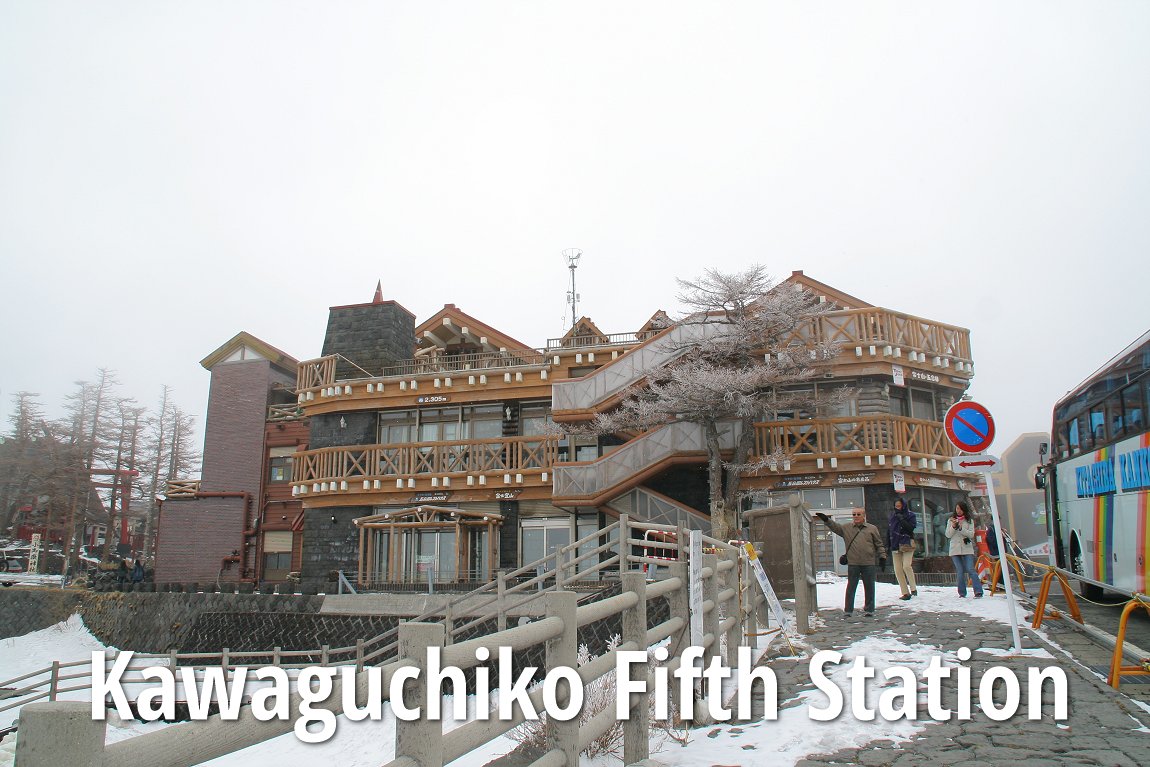
Details on Kawaguchi Fifth Station
DetailsThe chance of having Mount Fuji free from clouds is highest in the morning, hence most people climb in the early hours of the morning, in time for sunrise. Sunrise is around 4:30am to 5:00am. The most popular way is to start your climb at 10:00pm from the Fifth Station, to reach the mountain huts at the 7th or 8th station. These overnight stays at the mountain hut costs ¥5000 without meals, and ¥7000 with two meals. Sleep for a few hours there, and then continuing your climb in time to catch the sunrise.
What to Bring
Hiking Tours of Mount Fuji
Many tour agencies offer 2-day-1-night climbing tours of Mount Fuji. These are expensive, costing about ¥30,000 per person. A day trip "superman" tour costs ¥20,000.List of Mountains in Japan
 Latest updates on Penang Travel Tips
Discover with Timothy YouTube Channel
PG Food Channel
Learn Penang Hokkien YouTube Channel
SojiMart Videos
Share your travels and/or ask a travel-related question
Join the Penang Travel Tips Facebook Group to share photos, tips and anything related to your travels, or ask travel-related questions.
 Map of Roads in Penang
Looking for information on Penang? Use this Map of Roads in Penang to zoom in on information about Penang, brought to you road by road. Discover with Timothy
Let me take you to explore and discover Penang through my series of walking tours on YouTube. You may use these videos as your virtual tour guide. At the beginning of each video, I provide the starting point coordinates which you may key into your GPS, Google Maps or Waze, to be navigated to where I start the walk, and use the video as your virtual tour guide.Disclaimer
Please use the information on this page as guidance only. The author endeavours to update the information on this page from time to time, but regrets any inaccuracies if there be any.Latest from Discover with Timothy: Gurney Bay - what to see and do there
About this website

Hello and thanks for reading this page. My name is Timothy and my hobby is in describing places so that I can share the information with the general public. My website has become the go to site for a lot of people including students, teachers, journalists, etc. whenever they seek information on places, particularly those in Malaysia and Singapore. I have been doing this since 5 January 2003, for over twenty years already. You can read about me at Discover Timothy. By now I have compiled information on thousands of places, mostly in Peninsular Malaysia and Singapore, and I continue to add more almost every day. My goal is to describe every street in every town in Malaysia and Singapore.
Robbie's Roadmap
- Episode 1: Robbie's Journey to Financial Freedom
- Episode 2: Lost in America
- Episode 3: The Value of Money
- Episode 4: The Mentor
- Episode 5: The Thing that Makes Money
- Episode 6: The walk with a Billionaire
- Episode 7: The Financial Freedom Awakening
- Episode 8: Meet Mr Washington
- Episode 9: The Pizzeria Incident
Copyright © 2003-2024 Timothy Tye. All Rights Reserved.