 Ikema Bridge, Miyako Island, Okinawa Prefecture
Source: http://commons.wikimedia.org/wiki/File:Miyako_ikema_bridge.JPG
Author: Metatron

Okinawa Prefecture (沖縄県) is the southernmost prefecture of Japan. It comprises a string of islands extending over a thousand kilometers southwest of Kyushu. The name Okinawa means "rope in the open sea", a most appropriate description of the islands. The cover a total area of 2,271.3 sq km and has a population of 1.4 million people (2011 estimate).
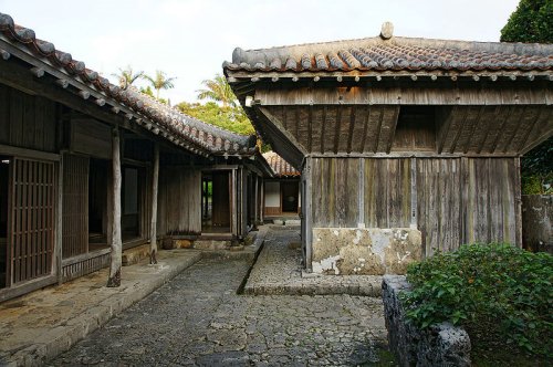
 Nakamura House, Kitanakagusuku, Okinawa Prefecture
Source: http://commons.wikimedia.org/wiki/File:Nakamura_House_Kitanakagusuku21n3104.jpg
Author: 663highland

Okinawa Prefecture includes the hundreds in the Ryukyu Islands group. Also included are the Senkaku Islands, also called the Diaoyu Islands or Pinnacle Islands, which are also claimed by China and Taiwan. The prefecture does not share any land borders with any other prefectures of Japan.
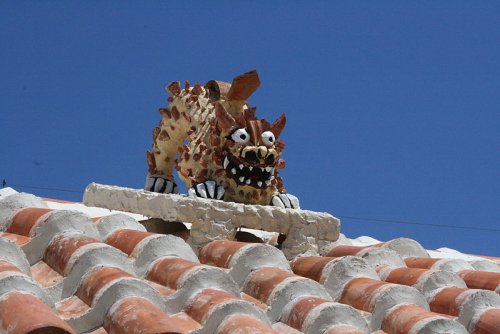
Due to its isolation from the rest of Japan, Okinawan develop their own language and customs that are distinct from mainland Japan. The most important cultural export of Okinawa is the martial artform called karate. A more local manifestation of Okinawan culture are the ubiquitous Shisa guardian lions, which can be seen at the gate or roof of almost every house in Okinawa.
 Shisa guardian lion, Okinawa Prefecture
Source: http://commons.wikimedia.org/wiki/File:%E5%90%8D%E8%AD%B7%E5%B8%82%E3%81%AE%E3%82%B7%E3%83%BC%E3%82%B5%E3%83%BC.JPG
Author: rbnature

Okinawa Prefecture has a subtropical climate. Even during the coldest month, January, the average high temperature of the day is still around 20°C (68°F). The best time to visit Okinawa is during late March and April. The wet season starts in early May and continues through June.
In keeping with its own culture and climate, Okinawa also has its own distinct cuisine. Pork-based dishes predominate the menu, and the Okinawa is said to consume every part of the pig - except the squeal!
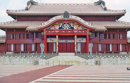
 Shuri Castle in Nara, Okinawa
Source: http://commons.wikimedia.org/wiki/File:ShuriCastle3.jpg
Author: Fg2

The economy of Okinawa Prefecture is heavily dependent on the US military bases located there, providing jobs to the local people. There are a total of fourteen US bases on the islands. Their presence has been a source of controversy and local resentment, heightened by criminal offences committed by the US servicemen there. The majority of the local population want all the bases to close while an almost equal percentage want to see a reduction. So far, no concrete solution has been taken.
Planning your trip to Okinawa Prefecture
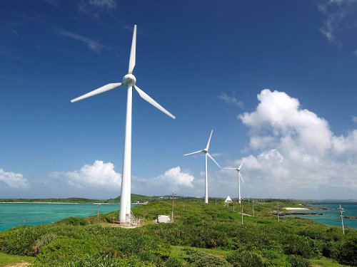
Naha Airport (OKA), located just 4 km from the city center of Naha, is the main airport for Okinawa Prefecture. It receives flights from major cities in Japan as well as from Hong Kong, Seoul, Shanghai, and Taipei. Wind turbines at Nishihennazaki, Miyako Island, Okinawa Prefecture
Source: http://commons.wikimedia.org/wiki/File:Miyako_nishihenna_turbines.jpg
Author: Paipateroma

Cities of Okinawa Prefecture
(Local Okinawan names shown in parentheses.)- Naha (Naafa) - capital
- Ginowan (Jinoon)
- Ishigaki (Ishigachi)
- Itoman (Ichuman)
- Miyakojima (Naaku)
- Nago (Nagu)
- Nanjo (Nanjoo)
- Okinawa (Uchinaa)
- Tomigusuku (Timigushiku)
- Urasoe (Urashii)
- Uruma (Uruma)
Tourist Attractions of Okinawa Prefecture
- Nakamura House, Kitanakagusuku
- Shuri Castle, Naha
 Latest updates on Penang Travel Tips
 Discover with Timothy YouTube Channel
 PG Food Channel
 Learn Penang Hokkien YouTube Channel
 SojiMart Videos
 Share your travels and/or ask a travel-related question
Join the Penang Travel Tips Facebook Group to share photos, tips and anything related to your travels, or ask travel-related questions.
 Map of Roads in Penang
Looking for information on Penang? Use this Map of Roads in Penang to zoom in on information about Penang, brought to you road by road. Discover with Timothy
Let me take you to explore and discover Penang through my series of walking tours on YouTube. You may use these videos as your virtual tour guide. At the beginning of each video, I provide the starting point coordinates which you may key into your GPS, Google Maps or Waze, to be navigated to where I start the walk, and use the video as your virtual tour guide.Disclaimer
Please use the information on this page as guidance only. The author endeavours to update the information on this page from time to time, but regrets any inaccuracies if there be any.Latest from Discover with Timothy: Gurney Bay - what to see and do there
About this website

Hello and thanks for reading this page. My name is Timothy and my hobby is in describing places so that I can share the information with the general public. My website has become the go to site for a lot of people including students, teachers, journalists, etc. whenever they seek information on places, particularly those in Malaysia and Singapore. I have been doing this since 5 January 2003, for over twenty years already. You can read about me at Discover Timothy. By now I have compiled information on thousands of places, mostly in Peninsular Malaysia and Singapore, and I continue to add more almost every day. My goal is to describe every street in every town in Malaysia and Singapore.
Robbie's Roadmap
- Episode 1: Robbie's Journey to Financial Freedom
- Episode 2: Lost in America
- Episode 3: The Value of Money
- Episode 4: The Mentor
- Episode 5: The Thing that Makes Money
- Episode 6: The walk with a Billionaire
- Episode 7: The Financial Freedom Awakening
- Episode 8: Meet Mr Washington
- Episode 9: The Pizzeria Incident
Copyright © 2003-2024 Timothy Tye. All Rights Reserved.


 Go Back