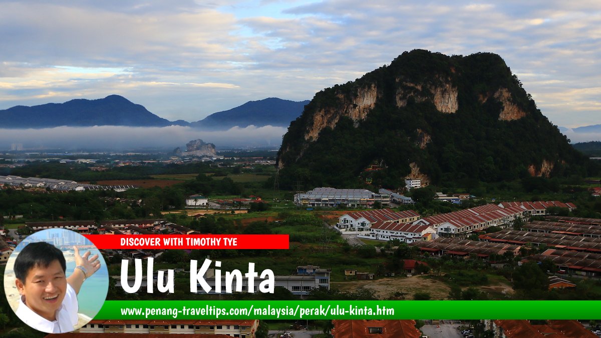
 Ulu Kinta, Perak (13 August 2017)
Ulu Kinta (GPS: 4.63601, 101.14713) is a neighbourhood on the northeast of Ipoh. It is located between Tambun in the south and Tanjung Rambutan in the north. The area is located on the upper reaches of the Kinta River.
Part of Ulu Kinta is still quite forested. It has a number of limestone hills the juts out of the flat land. A protected area has been made the Ulu Kinta Recreational Forest (Hutan Lipur Ulu Kinta). Within it is the Tanjung Rambutan Waterfall.
Map of Ulu Kinta, Perak
Sights in Ulu Kinta
- Chan Kong Kok Moral Uplifting Society (GPS: 4.65202, 101.15439)

- Sri Maha Kaliamman Temple (GPS: 4.65129, 101.15616)

- St Mary's Chapel (GPS: 4.65225, 101.15614)

- The Haven Resort Ipoh (GPS: 4.63655, 101.16221)

- Tung Wah Tong Temple (GPS: 4.64438, 101.15573)

Streets in Ulu Kinta, Perak
Ulu Kinta is  on the Map of towns in Perak
Back to Perak mainpage; list of Towns in Perak and Towns in Malaysia
 Latest updates on Penang Travel Tips
 Discover with Timothy YouTube Channel
 PG Food Channel
 Learn Penang Hokkien YouTube Channel
 SojiMart Videos
Latest from Discover with Timothy: Gurney Bay - what to see and do there
About this website

Hello and thanks for reading this page. My name is Timothy and my hobby is in describing places so that I can share the information with the general public. My website has become the go to site for a lot of people including students, teachers, journalists, etc. whenever they seek information on places, particularly those in Malaysia and Singapore. I have been doing this since 5 January 2003, for over twenty years already. You can read about me at Discover Timothy. By now I have compiled information on thousands of places, mostly in Peninsular Malaysia and Singapore, and I continue to add more almost every day. My goal is to describe every street in every town in Malaysia and Singapore.
Robbie's Roadmap
- Episode 1: Robbie's Journey to Financial Freedom
- Episode 2: Lost in America
- Episode 3: The Value of Money
- Episode 4: The Mentor
- Episode 5: The Thing that Makes Money
- Episode 6: The walk with a Billionaire
- Episode 7: The Financial Freedom Awakening
- Episode 8: Meet Mr Washington
- Episode 9: The Pizzeria Incident
Copyright © 2003-2024 Timothy Tye. All Rights Reserved.


 Go Back