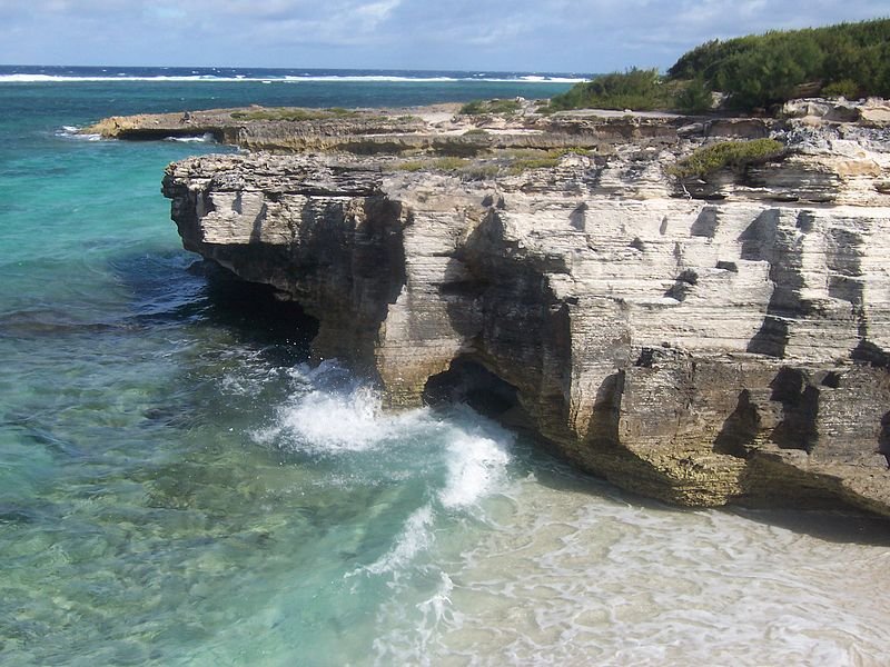
 Calcarenitic shore of Rodrigues Island, Mauritius
 http://commons.wikimedia.org/wiki/File:Rodrigues_CalcareniticShore.jpg
 B.navez
Mauritius is an island nation in the Indian Ocean. It is located on the southwestern part of the ocean, about 900 km (560 mi) to the east of Madagascar. It comprises the main island, Mauritius, and adjacent islands including Cargados, Carajos, Rodrigues and the Agalega Islands. It is one of the Mascarene Islands, which includes Réunion. It covers a total land area of 2,040 sq km (787 sq mi).
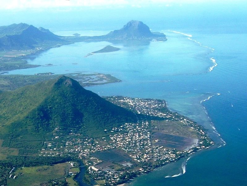
 Aerial view of Mauritius
 http://commons.wikimedia.org/wiki/File:Ilemaurice.JPG
 Shardan
Mauritius has a population of 1.3 million people (2011 estimate). The official language of the country is English, although the people here also speak Mauritian Creole, French and Rodriguan Croele.
Mauritius is four hours ahead of Coordinated Universal Time (UTC+4). Electricity is 230V/50Hz using European and UK plugs. The official currency is the Mauritian rupee (MUR). Traffic is driven on the left, just as in Britain. The phone IDD code is +230. The country has a tropical climate with temperatures that are fairly constant throughout the year.
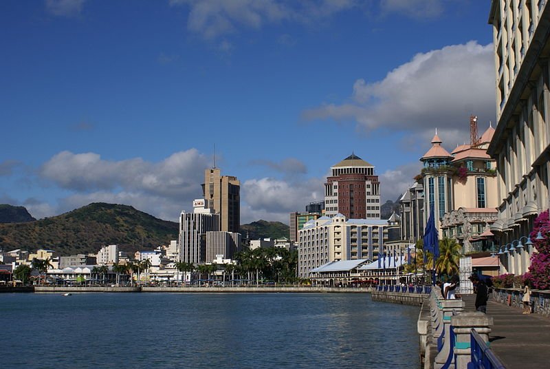
 Caudan Waterfront at Port Louis, Mauritius
 http://commons.wikimedia.org/wiki/File:Mauritius_Port-Louis_CaudanWaterfront.JPG
 B.navez
In 2009, Mauritius had an estimated nominal GDP of $8.761 billion, equivalent to a per capita nominal GDP of $6,838. Its per capita GDP at purchasing power parity stood at $12,526. When aligned with other countries of Africa, its GDP at purchasing power parity is the sixth highest behind Seychelles, Equatorial Guinea, Gabon, Libya and Botswana. From the time of independence until today, the country has transformed its economy, from one based on agriculture, to one based on services and tourism.
The history of Mauritius goes back to at least the 10th century. Early seafarers from Arabia, Africa and the Malay archipelago have visited it. The Portuguese arrived here in 1507 and established a base on one of its islands. The Dutch Second Fleet, comprising five ships, were blown off course by a cyclone, and beached at Mauritius in 1598. The Dutch named the island after Prince Maurice of Nassau, the then Stadtholder of the Netherlands.
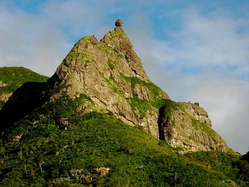
 Pieter Both mountain peak in Mauritius
 http://commons.wikimedia.org/wiki/File:Pieter_Both,_mountain.jpg
 Avinash Meetoo
The French took control of Mauritius in 1715, and renamed it Île de France. During the Napoleonic Wars, the British took over the island from the French, and changed its name back to Mauritius. The British continued to administered the island until its independence in 1968. Mauritius became a republic in 1992. It is a member of the Commonwealth of Nations as well as the African Union and La Francophonie.
Planning your visit to Mauritius
Visitors from most Western countries as well as citizens of Japan, Malaysia and Singapore do not need a visa for entering Mauritius. The Sir Seewoosagur Ramgoolam International Airport is the gateway to Mauritius. It is the base for Air Mauritius, the national carrier, which flies to destinations in Africa, Australia, Asia and Europe.Preparing Money for your trip to Mauritius
The currency used in Mauritius is the Mauritian Rupee (MUR).- Port Louis - capital
- Beau Bassin
- Curepipe
- Rose Hill
- Phoenix
- Quatre Bornes
- Vacoas
Places of Interest in Mauritius
- Domaine du Chasseur Nature Preserve
- Macabée Bel Ombre Nature Preserve
- Rodrigues
World Heritage Sites in Mauritius
- Aapravasi Ghat
- Le Morne Cultural Landscape
 Latest updates on Penang Travel Tips
 Discover with Timothy YouTube Channel
 PG Food Channel
 Learn Penang Hokkien YouTube Channel
 SojiMart Videos
 Share your travels and/or ask a travel-related question
Join the Penang Travel Tips Facebook Group to share photos, tips and anything related to your travels, or ask travel-related questions.
 Map of Roads in Penang
Looking for information on Penang? Use this Map of Roads in Penang to zoom in on information about Penang, brought to you road by road. Discover with Timothy
Let me take you to explore and discover Penang through my series of walking tours on YouTube. You may use these videos as your virtual tour guide. At the beginning of each video, I provide the starting point coordinates which you may key into your GPS, Google Maps or Waze, to be navigated to where I start the walk, and use the video as your virtual tour guide.Disclaimer
Please use the information on this page as guidance only. The author endeavours to update the information on this page from time to time, but regrets any inaccuracies if there be any.Latest from Discover with Timothy: Gurney Bay - what to see and do there
About this website

Hello and thanks for reading this page. My name is Timothy and my hobby is in describing places so that I can share the information with the general public. My website has become the go to site for a lot of people including students, teachers, journalists, etc. whenever they seek information on places, particularly those in Malaysia and Singapore. I have been doing this since 5 January 2003, for over twenty years already. You can read about me at Discover Timothy. By now I have compiled information on thousands of places, mostly in Peninsular Malaysia and Singapore, and I continue to add more almost every day. My goal is to describe every street in every town in Malaysia and Singapore.
Robbie's Roadmap
- Episode 1: Robbie's Journey to Financial Freedom
- Episode 2: Lost in America
- Episode 3: The Value of Money
- Episode 4: The Mentor
- Episode 5: The Thing that Makes Money
- Episode 6: The walk with a Billionaire
- Episode 7: The Financial Freedom Awakening
- Episode 8: Meet Mr Washington
- Episode 9: The Pizzeria Incident
Copyright © 2003-2024 Timothy Tye. All Rights Reserved.


 Go Back