 Pokhara, Nepal
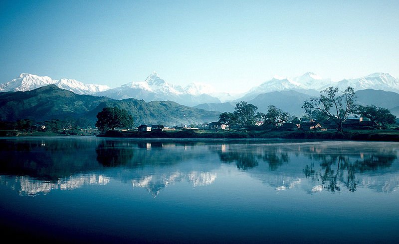
Source: https://commons.wikimedia.org/wiki/File:Pokhara_and_Phewa_Lake.jpg
Author: Wolfgang Beyer

Pokhara (पोखरा) is a small, rather messy Nepali town within a scenic location. It is located some 200 kilometers to the west of Kathmandu. With a population of 200,000, it is said to be the third largest metropolitan area in Nepal after Kathmandu Valley and Biratnagar.
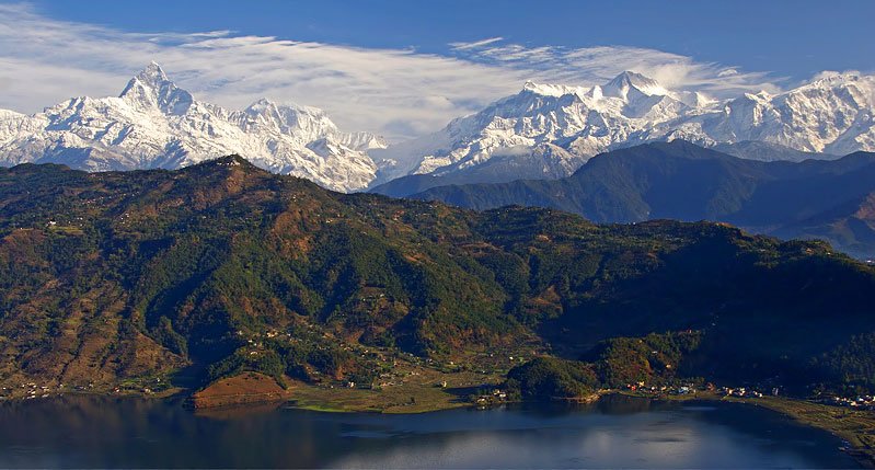
Pokhara sits in a bowl surrounded by tall mountains. It is about 900 meters above sea level, but within 30 kilometers from Pokhara, are mountains reaching 7,500 meters. The most distinctive feature of the town is Lake Phewa, a 4.4 square kilometer lake at 800 meters above sea level. This is where one can catch breathtaking views of the surrounding mountains including the Dhaulagiri, Annapurna, Manaslu and the most famous of all, the Machapuchare.
 Annapurna Range, as seen from Phewa Lake in Pokhara
Source: https://commons.wikimedia.org/wiki/File:AnapurnaFromPokhara.jpg
Author: Jean-Marie Hullot

The warmest months in Pokhara are April to September, when the temperature rises to around 26.1°C (79°F). In December and January, the temperature drops to below 5°C (41°F). Heaviest rain is expected in the months of July and August, with precipitatioin of over 325 mm (12.8 inches) for each month.
Travel to Pokhara
You can get to Pokhara by taking a bus from Kathmandu. The journey takes a good 9 hours with a stop along the way, and costs between 280 to 380 Nepali rupees. Alternatively you can fly from Kathmandu to Pokhara for US$90 each way, in just half an hour. A flight to Pokhara gives you an aerial view of the snowcapped peaks.Travel within Pokhara
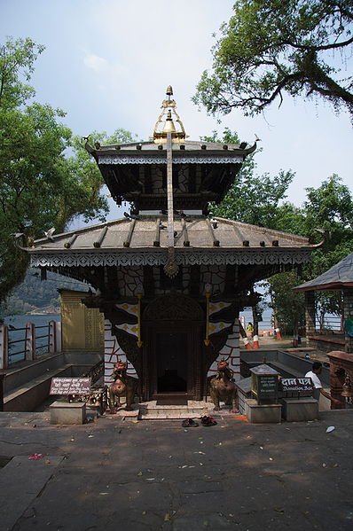
You can easily explore Pokhara on foot. Take the motorised rickshaws only when the distance is too far. Barahi Temple on Phewa Lake, Pokhara
Source: https://commons.wikimedia.org/wiki/File:Barahi_temple,_Phewa_lake,_Pokhara.jpg
Author: Tom Booth

Places of Interest in Pokhara
- Phewa Lake
The biggest of the eight lakes in Pokhara, with wonderful views of the mountains. - Lakeside
Tourist quarters on the eastern shore of Phewa Lake. - Damside
Tourist quarters on the southern shore of Phewa Lake. - Bindyabasini Temple
Temple in Pokhara dedicated to an avatar of the goddess Bhagvati. - Annapurna Regional Museum
Museum within the Prithvi Narayan Campus, with exhibits of local flora and fauna. - Barahi Temple
Tiny shaded temple on an island in Phewa Lake. - Pokhara Museum
Museum displaying traditional costumes, tools and other items of the different ethnic groups in the Pokhara region. - Tiger Mountain Pokhara Lodge
Luxury lodge with the best view of Machapuchare. - Devi's Falls
A sinkhole with a river making a waterfall into it. - Tashi Ling Tibetan Settlement
One of the three Tibetan refugee camps in Pokhara. - Tashi Palkhel
The biggest Tibetan refugee camp in Pokhara, located near Hyangja. - Mahendra Gupha
Limestone caverns at the village of Batulechaur. - Sarangkot
Hilltop viewpoint located at 1,592 meters. - Tansen
Charming trading town located half a day from Pokhara.
 Latest updates on Penang Travel Tips
 Discover with Timothy YouTube Channel
 PG Food Channel
 Learn Penang Hokkien YouTube Channel
 SojiMart Videos
 Share your travels and/or ask a travel-related question
Join the Penang Travel Tips Facebook Group to share photos, tips and anything related to your travels, or ask travel-related questions.
 Map of Roads in Penang
Looking for information on Penang? Use this Map of Roads in Penang to zoom in on information about Penang, brought to you road by road. Discover with Timothy
Let me take you to explore and discover Penang through my series of walking tours on YouTube. You may use these videos as your virtual tour guide. At the beginning of each video, I provide the starting point coordinates which you may key into your GPS, Google Maps or Waze, to be navigated to where I start the walk, and use the video as your virtual tour guide.Disclaimer
Please use the information on this page as guidance only. The author endeavours to update the information on this page from time to time, but regrets any inaccuracies if there be any.Latest from Discover with Timothy: Gurney Bay - what to see and do there
About this website

Hello and thanks for reading this page. My name is Timothy and my hobby is in describing places so that I can share the information with the general public. My website has become the go to site for a lot of people including students, teachers, journalists, etc. whenever they seek information on places, particularly those in Malaysia and Singapore. I have been doing this since 5 January 2003, for over twenty years already. You can read about me at Discover Timothy. By now I have compiled information on thousands of places, mostly in Peninsular Malaysia and Singapore, and I continue to add more almost every day. My goal is to describe every street in every town in Malaysia and Singapore.
Robbie's Roadmap
- Episode 1: Robbie's Journey to Financial Freedom
- Episode 2: Lost in America
- Episode 3: The Value of Money
- Episode 4: The Mentor
- Episode 5: The Thing that Makes Money
- Episode 6: The walk with a Billionaire
- Episode 7: The Financial Freedom Awakening
- Episode 8: Meet Mr Washington
- Episode 9: The Pizzeria Incident
Copyright © 2003-2024 Timothy Tye. All Rights Reserved.


 Go Back