 Krabi Province, Thailand (4 November 2005)
Krabi Province จังหวัดกระบี่
 , is a province of Thailand in the Southern Region. It faces the Andaman Sea, and is bordered by Phang Nga Province tothe west, Surat Thani Province to the north, Nakhon Si Thammarat Province to the east and Trang Province to the southeast.
Krabi Province covers 4,708 sq km (1,818 sq mi) and has a population of 438,000 people (2012 estimate). It ranks 46th in terms of size and 64th in terms of population. The province is divided into 8 districts or amphoe, namely Mueang Krabi (Krabi Town), Khao Phanom, Ko Lanta, Khlong Thom, Ao Luek, Plai Phraya, Lam Thap and Nuea Khlong. The provincial capital is Krabi Town.
Map of Krabi Province, Thailand
Places of Interest in Krabi Province
- Ao Nang (GPS: 8.03126, 98.82197)
 อ่าวนาง
  A bay that has developed into Krabi's main tourist destination.
 - Railay Beach (GPS: 8.01333, 98.83742)

- Khao Pra-Bang Khram Wildlife Sanctuary เขตรักษาพันธุ์สัตว์ป่าเขาประ - บางคราม

- Khlong Thom Hot Waterfall (GPS: 7.90492, 99.10876)
 น้ำตกร้อนคลองท่อม
  A waterfall within a hot spring.
 - Ko Lanta (GPS: 7.62436, 99.07922)

- Ko Ngai เกาะไหง
 @ Koh Hai (เกาะไหง
  (GPS: 7.41557, 99.20375)
- Ko Poda (GPS: 7.97181, 98.80949)

- Ko Poda Nok (GPS: 7.9539, 98.80686)

- Ko Ma Tang Ming (GPS: 7.97757, 98.80874)

- Ko Maiphai เกาะไม้ไผ่
 (GPS: 7.81729, 98.79549)
- Ko Mor (GPS: .96101, 98.80999)

- Ko Tap (GPS: 7.96081, 98.81208)

- Ko Yung เกาะยุง
 (GPS: 7.81704, 98.77296)
- Noppharat Thara Beach (GPS: 8.04181, 98.81163)
 หาดนพรัตน์ธารา
  A beach area located next to Aonang.
 - Tha Pom Khlong Song Nam (GPS: 8.21394, 98.77813)
 A crystal-clear river in the middle of a mangrove swamp.
 - Phi Phi Island (GPS: 7.74073, 98.77841)
 หมู่เกาะพีพี
  One of the most beautiful islands in the world.
 - Pranang Beach
- Sra Morakot
 (GPS: 7.92159, 99.25967)
- Susan Hoi (GPS: 8.02258, 98.8831)
 สุสานหอย
  A beach with fossil remains.
 - Wat Khlong Thom Thai Buddhist temple in the district of Khlong Thom.
National Parks in Krabi Province
1. Mu Koh Phi Phi National Park.2. Mu Ko Lanta National Park อุทยานแห่งชาติหมู่เกาะลันตา

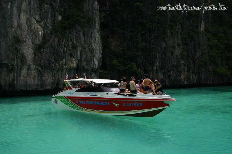
 Motorboat afloat in the crystal clear lagoon of Phi Phi Ley (4 November, 2005)
Evidence of human habitation in the area of Krabi Province goes back as far as 35,000 BC, based on discovery of human remains there. Documented history goes back to the 13th century, when the Kingdom of Ligor was established. In more recent history, Krabi was part of Nakhon Si Thammarat until 1875, when the province was created. The provincial capital was initially at Ban Talad Kao, but was relocated to the mouth of the Krabi River in 1900.
Krabi Province is noted for its karst landscape, with numerous limestone outcrops on land and in the form of islets in the sea. Perhaps the most famous tourist attractions are the islands of Phi Phi and Ko Lanta.
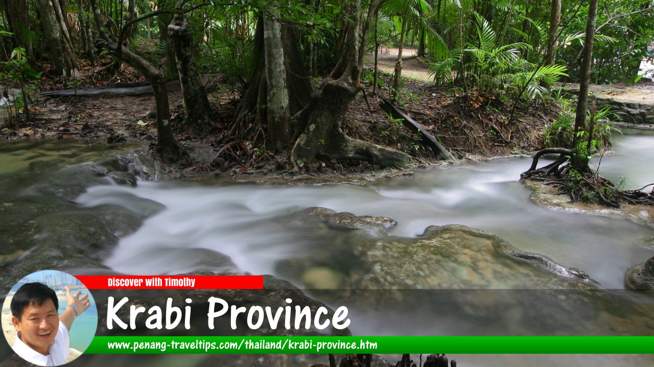
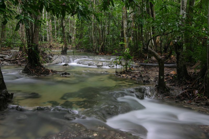
 Sra Morakot, Krabi Province (3 November, 2005)
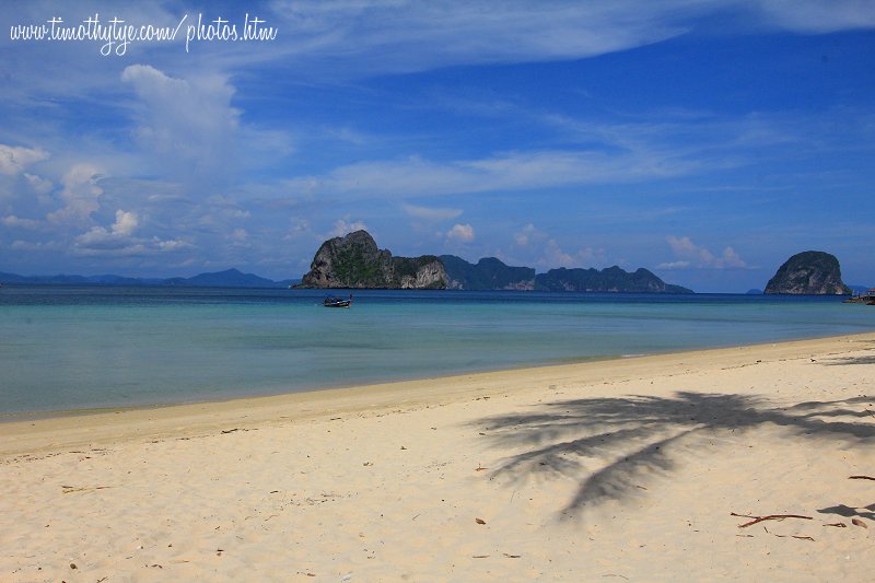
 Andaman Sea, as seen from Ko Ngai towards Trang Province (11 May, 2014)
 Latest updates on Penang Travel Tips
 Discover with Timothy YouTube Channel
 PG Food Channel
 Learn Penang Hokkien YouTube Channel
 SojiMart Videos
 Share your travels and/or ask a travel-related question
Join the Penang Travel Tips Facebook Group to share photos, tips and anything related to your travels, or ask travel-related questions.
 Map of Roads in Penang
Looking for information on Penang? Use this Map of Roads in Penang to zoom in on information about Penang, brought to you road by road. Discover with Timothy
Let me take you to explore and discover Penang through my series of walking tours on YouTube. You may use these videos as your virtual tour guide. At the beginning of each video, I provide the starting point coordinates which you may key into your GPS, Google Maps or Waze, to be navigated to where I start the walk, and use the video as your virtual tour guide.Disclaimer
Please use the information on this page as guidance only. The author endeavours to update the information on this page from time to time, but regrets any inaccuracies if there be any.Latest from Discover with Timothy: Gurney Bay - what to see and do there
About this website

Hello and thanks for reading this page. My name is Timothy and my hobby is in describing places so that I can share the information with the general public. My website has become the go to site for a lot of people including students, teachers, journalists, etc. whenever they seek information on places, particularly those in Malaysia and Singapore. I have been doing this since 5 January 2003, for over twenty years already. You can read about me at Discover Timothy. By now I have compiled information on thousands of places, mostly in Peninsular Malaysia and Singapore, and I continue to add more almost every day. My goal is to describe every street in every town in Malaysia and Singapore.
Robbie's Roadmap
- Episode 1: Robbie's Journey to Financial Freedom
- Episode 2: Lost in America
- Episode 3: The Value of Money
- Episode 4: The Mentor
- Episode 5: The Thing that Makes Money
- Episode 6: The walk with a Billionaire
- Episode 7: The Financial Freedom Awakening
- Episode 8: Meet Mr Washington
- Episode 9: The Pizzeria Incident
Copyright © 2003-2024 Timothy Tye. All Rights Reserved.


 Go Back