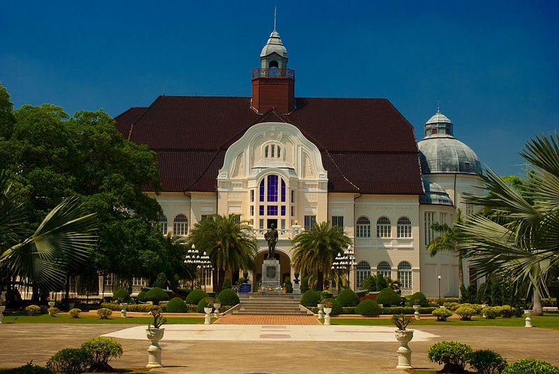
 Phra Ram Ratchaniwet
 https://commons.wikimedia.org/wiki/File:Ban_peun01.jpg
 Kawpodmd
Phetchaburi Province จังหวัดเพชรบุรี
 is a province of Thailand on the northern part of the Isthmus of Kra. It covers 6,225 square kilometers and has a population of 467,000 people (2011 estimate). The provincial capital is called Phetchaburi Town.
Phetchaburi Province is bordered by Ratchaburi Province to the northwest, Samut Songkhram Province to the northeast, the Gulf of Thailand to the east, Prachuap Khiri Khan Province to the south, and Myanmar to the west. The Tanaosi Mountains separates Phetchaburi Province from Myanmar.
On the western part of Phetchaburi Province, covering an area close to half the entire province, is Kaeng Krachan National Park, the largest national park in Thailand. The national park is clad mostly in rainforest, and is rich in various fauna and flora.
Phetchaburi Province on Google Street View
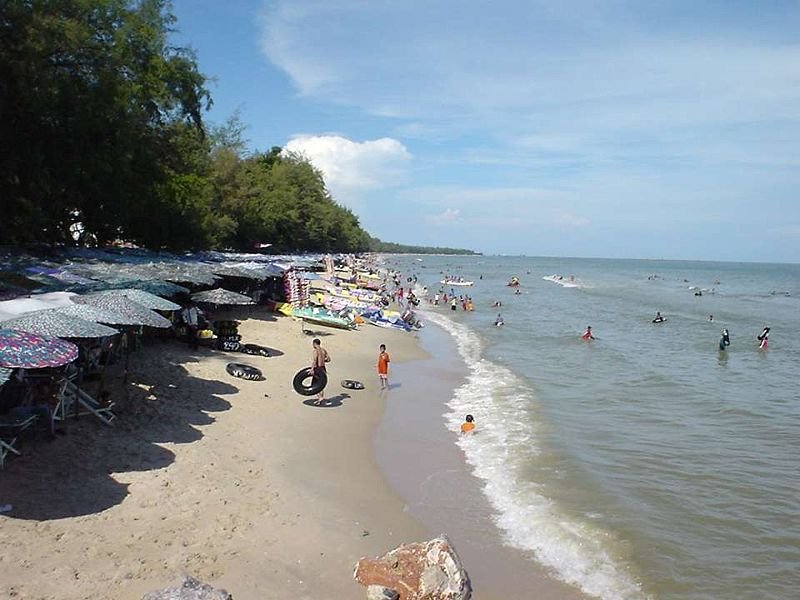
On this street view, I show Thanon Phetkasem (Route AH2) as it passes through Phetchaburi. Hat Cha Am
 https://commons.wikimedia.org/wiki/File:Cha_Am_Beach.jpg
 Ahoerstemeier
Tourist Attractions in Phetchaburi Province
- Hat Cha Am, a seaside resort
- Hat Chao Samran, which means "beach of royal leisure", as legend has it that King Naresuan the Great and King Eka Thotsarot had their holidays there.
- Hat Puek Tian
- Huai Sai Wildlife Breeding Centre, located 14 km south of Cha-am.
- Kaeng Krachan Dam, a reservoir with panoramic views all around.
- Khao Luang Caves, or Tham Khao Luang, a cave that houses a Buddha image cast under the command of King Rama V and dedicated to King Rama III
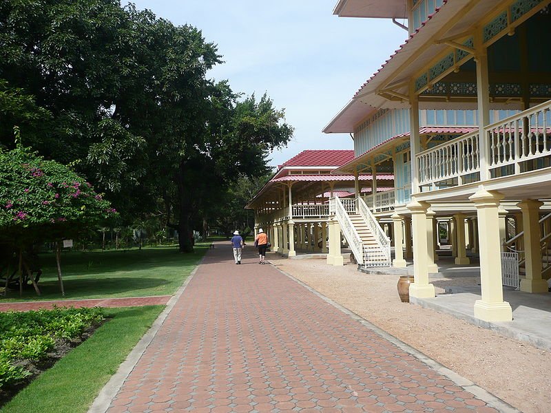
- Maruekhathaiyawan Palace, the royal summer residence of King Rama VI in the 1920s.
- Phra Nakhon Khiri Historical Park, an area preserving historical temples and old palace complex.
- Phra Ram Ratchaniwet, European-style palace built on the command of King Rama V as a rainy season palace, in 1916.
- Wat Kamphaeng Laeng, originally a Khmer temple that was converted into a Thai Buddhist temple.
- Wat Mahathat Worawihan, a five-tier constructed in the Mahayana Buddhist style. It enshrines Buddha relics.
- Wat Yai Suwannaram, Buddhist temple housing 300-year-old murals depicting Buddhist legends.
 Maruekhathaiyawan Palace in Cha Am
 https://commons.wikimedia.org/wiki/File:Mrigadayavan_Palace_by_Heuristics.jpg
 Heuristics
 Latest updates on Penang Travel Tips
 Discover with Timothy YouTube Channel
 PG Food Channel
 Learn Penang Hokkien YouTube Channel
 SojiMart Videos
 Share your travels and/or ask a travel-related question
Join the Penang Travel Tips Facebook Group to share photos, tips and anything related to your travels, or ask travel-related questions.
 Map of Roads in Penang
Looking for information on Penang? Use this Map of Roads in Penang to zoom in on information about Penang, brought to you road by road. Discover with Timothy
Let me take you to explore and discover Penang through my series of walking tours on YouTube. You may use these videos as your virtual tour guide. At the beginning of each video, I provide the starting point coordinates which you may key into your GPS, Google Maps or Waze, to be navigated to where I start the walk, and use the video as your virtual tour guide.Disclaimer
Please use the information on this page as guidance only. The author endeavours to update the information on this page from time to time, but regrets any inaccuracies if there be any.Latest from Discover with Timothy: Gurney Bay - what to see and do there
About this website

Hello and thanks for reading this page. My name is Timothy and my hobby is in describing places so that I can share the information with the general public. My website has become the go to site for a lot of people including students, teachers, journalists, etc. whenever they seek information on places, particularly those in Malaysia and Singapore. I have been doing this since 5 January 2003, for over twenty years already. You can read about me at Discover Timothy. By now I have compiled information on thousands of places, mostly in Peninsular Malaysia and Singapore, and I continue to add more almost every day. My goal is to describe every street in every town in Malaysia and Singapore.
Robbie's Roadmap
- Episode 1: Robbie's Journey to Financial Freedom
- Episode 2: Lost in America
- Episode 3: The Value of Money
- Episode 4: The Mentor
- Episode 5: The Thing that Makes Money
- Episode 6: The walk with a Billionaire
- Episode 7: The Financial Freedom Awakening
- Episode 8: Meet Mr Washington
- Episode 9: The Pizzeria Incident
Copyright © 2003-2024 Timothy Tye. All Rights Reserved.


 Go Back