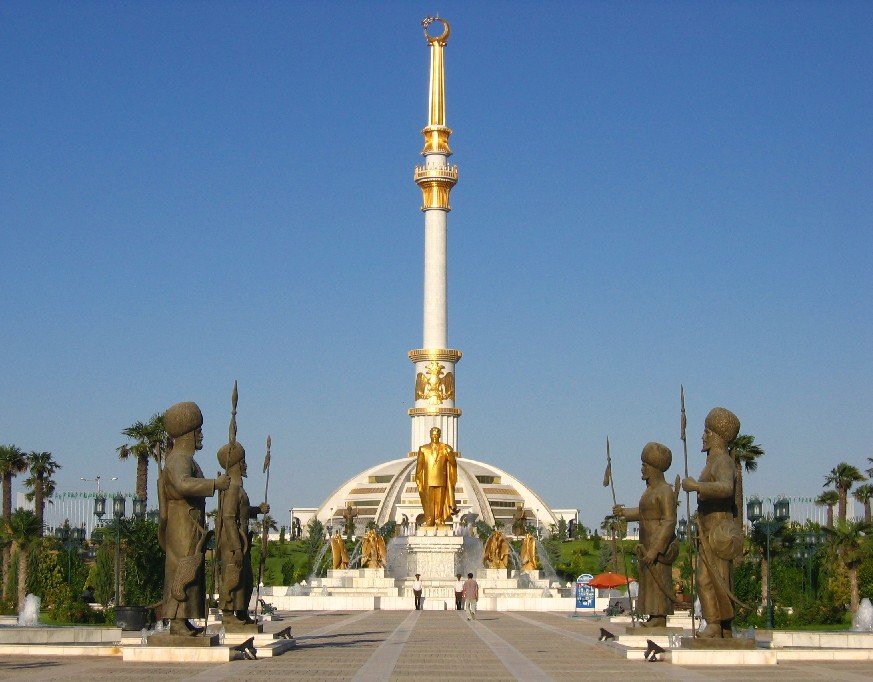
 Independence Monument, Ashgabat
Source: https://commons.wikimedia.org/wiki/File:IndependenceMonumentAshgabat.jpg
Author: Doluca

Ashgabat (Turkmen: Aşgabat, Persian: اشک آباد, Russian: Ашхаба́д) is the capital and largest city in Turkmenistan. Located on the southern part of the country, near the border with Iran, Ashgabat has a population approaching a million people (2012 estimate).
Situated between the Kara Kum desert and the Kopet Dag mountain range, Ashgabat experiences an arid climate. In July, the average high temperature can reach 38.2°C (100.8°F). On the other hand, during winter, particularly January, temperature may drop to -16°C (3°F), with the average between -1.6 to 0.7°C (29.1 nto 33.3°F). However it rarely snows here. The city receives only 227 mm (8.94 in) of precipitation throughout the year.
Ashgabat traces its beginnings to a fortress built here for the Russian Empire in 1869. A village was then established in 1881. It is located close to the ancient capital of the Parthian Empire, Nisa, and was built on the ruins of the ancient Silk Road city of Konjikala. It first came under Soviet rule in 1917. In 1919 it was renamed Poltoratsk, but the name Ashgabat was restored in 1927, with the founding of the Turkmen SSR as a Soviet republic.
Ashgabat was severely devastated by a massive earthquake in 1948. According to estimates, some two-thirds of the population was killed while official figures by Soviet news was a casualty of 40,000. Today the city has largely rebuilt itself and has a number of tourist sights.
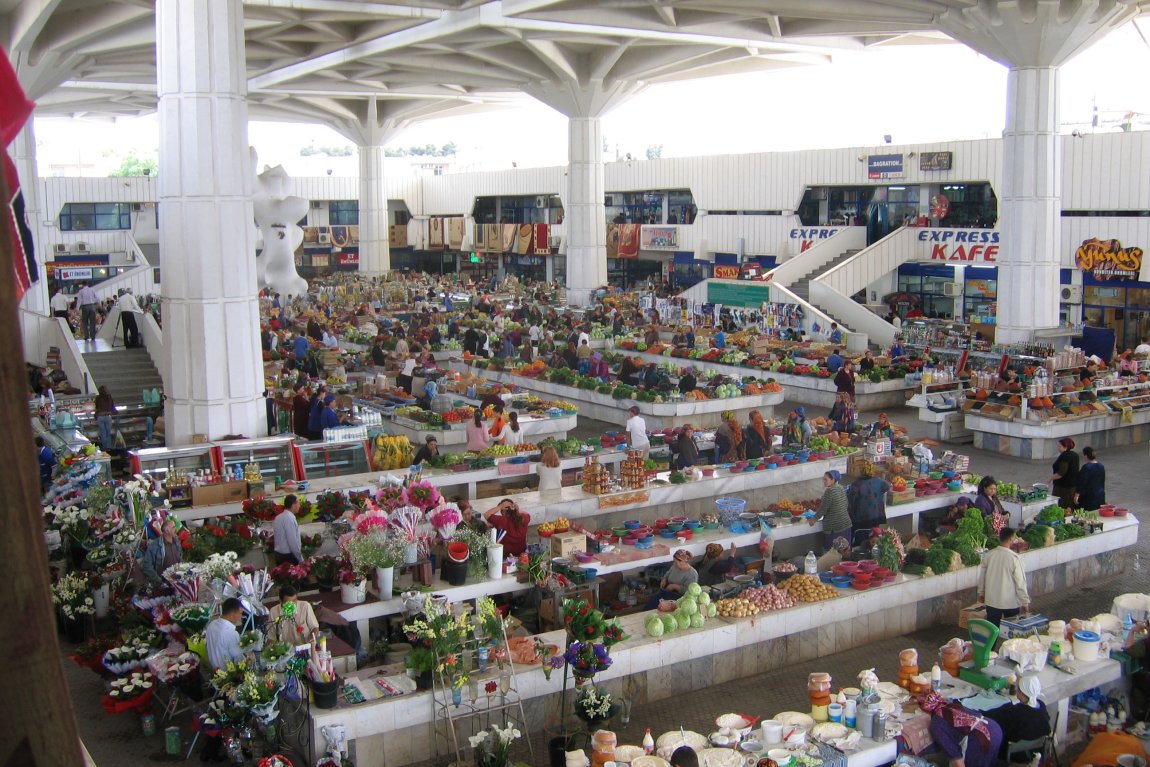
 Russian Bazaar, Ashgabat
Source: https://commons.wikimedia.org/wiki/File:Russian_Baazar.jpg
Author: Gilad Rom

Sights & Attractions to visit in Ashgabat
- Arch of Neutrality
- Azadi Mosque
- Bahá'í House of Worship
- Gypjak Mosque
- Inspiration Alley
- National Museum of History
- Neutrality Arch
- Olympic Stadium
- Tolkuchka Bazaar
- Turkmen Carpet Museum
- Turkmen Fine Arts Museum
- TV Tower
 Latest updates on Penang Travel Tips
 Discover with Timothy YouTube Channel
 PG Food Channel
 Learn Penang Hokkien YouTube Channel
 SojiMart Videos
 Share your travels and/or ask a travel-related question
Join the Penang Travel Tips Facebook Group to share photos, tips and anything related to your travels, or ask travel-related questions.
 Map of Roads in Penang
Looking for information on Penang? Use this Map of Roads in Penang to zoom in on information about Penang, brought to you road by road. Discover with Timothy
Let me take you to explore and discover Penang through my series of walking tours on YouTube. You may use these videos as your virtual tour guide. At the beginning of each video, I provide the starting point coordinates which you may key into your GPS, Google Maps or Waze, to be navigated to where I start the walk, and use the video as your virtual tour guide.Disclaimer
Please use the information on this page as guidance only. The author endeavours to update the information on this page from time to time, but regrets any inaccuracies if there be any.Latest from Discover with Timothy: Gurney Bay - what to see and do there
About this website

Hello and thanks for reading this page. My name is Timothy and my hobby is in describing places so that I can share the information with the general public. My website has become the go to site for a lot of people including students, teachers, journalists, etc. whenever they seek information on places, particularly those in Malaysia and Singapore. I have been doing this since 5 January 2003, for over twenty years already. You can read about me at Discover Timothy. By now I have compiled information on thousands of places, mostly in Peninsular Malaysia and Singapore, and I continue to add more almost every day. My goal is to describe every street in every town in Malaysia and Singapore.
Robbie's Roadmap
- Episode 1: Robbie's Journey to Financial Freedom
- Episode 2: Lost in America
- Episode 3: The Value of Money
- Episode 4: The Mentor
- Episode 5: The Thing that Makes Money
- Episode 6: The walk with a Billionaire
- Episode 7: The Financial Freedom Awakening
- Episode 8: Meet Mr Washington
- Episode 9: The Pizzeria Incident
Copyright © 2003-2024 Timothy Tye. All Rights Reserved.


 Go Back