
Chernivtsi (Чернівці), Ukraine
 Go Back - Latest PENANG Sights/Streets/New Properties > Malaysia > World | Hokkien : Lessons : Dictionary | YouTube | Facebook | About Me : Contact Me
 Theater Square, Chernivtsi, Ukraine
Source: https://commons.wikimedia.org/wiki/File:Chern-Panorama2.jpg
Author: Sasha-korol

Chernivtsi (Ukrainian: Чернівці, German: Czernowitz, Polish: Czerniowce, Romanian: Cernăuţi, Russian: Черновцы, Yiddish: טשערנאוויץ) is a city in southwestern Ukraine. It covers 153 sq km (59.1 sq mi) and has a population of 250,000 people (2011 estimate). The city is 248 m (814 ft) above sea level.
Chernivtsi is located on the River Prut, which flows into the Danube. It is within the region of Bukovina, which today is divided between Ukraine and Romania. It is today one of the cultural centers of western Ukraine, along with Lviv. It also plays an important role as an educational center for the country.
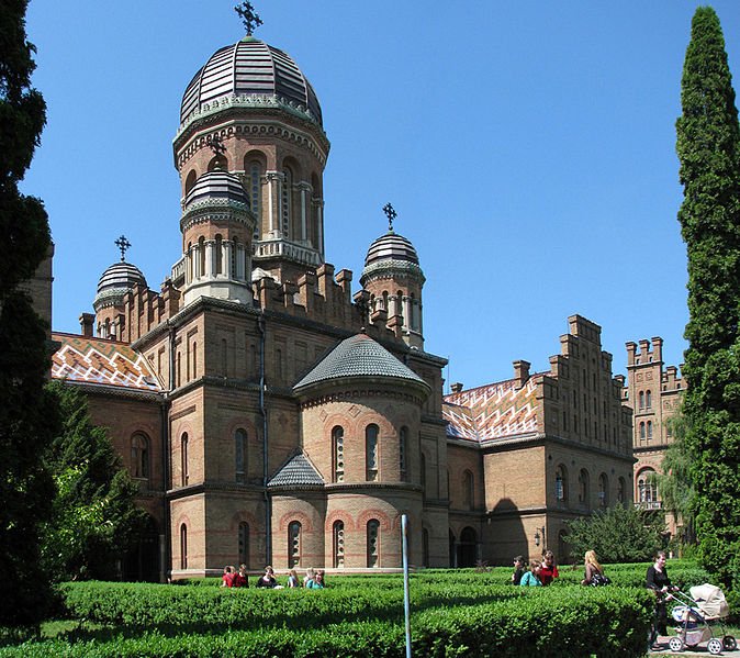
 Chernivtsi University Building, today a World Heritage Site
Source: https://commons.wikimedia.org/wiki/File:Chern_univer.jpg
Author: Sasha-korol

The Chernivtsi area has been inhabited since the Neolithic era. Ancient cultures that appeared here included the Cucuteni-Trypillian culture and the Corded Ware culture. Their artifacts have been uncovered and studied by archaeologists.
Chernivtsi is believed to date back to a fortified settlement established in the 12th century, during the time of the Principality of Halych. The fortress may have been destroyed by the Mongols when they swept through Europe in 1259. Parts of it remained, and in the 17th century, were augmented with a few more bastions, one of which is still standing today.
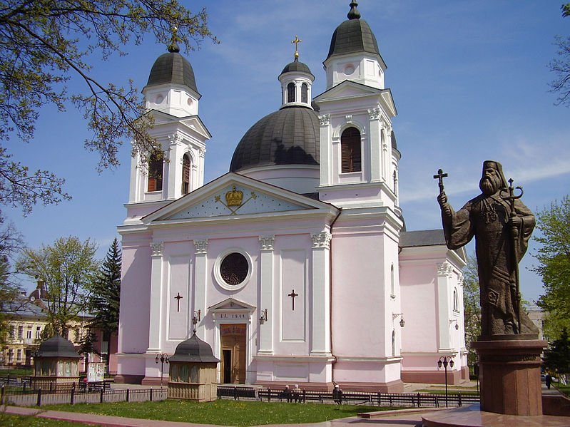
 Cathedral and Statue of Gakmanu, the Metropolitan of Chernivtsi
Source: https://commons.wikimedia.org/wiki/File:Chern_sobor.jpg
Author: Sasha-korol

The earliest mention of Chernivtsi appeared in 1408, in a document by Alexander the Good. At that time, the city was an administrative center under the Principality of Moldavia. Then in 1775, Moldavia was annexed by the Austrian Empire, and Chernivtsi became the capital of the Bukovina region.
When Romania and Ukraine pushed for independence, the Bukovina region was torn between them. Chernivtsi became part of the Bukovina region in the Ukraine. It was occupied by the Nazis during the Second World War until 1944, when the Red Army ousted them from Chernivtsi, and added it to the Ukrainian SSR. In 1991, Chernivtsi became part of the independent Ukraine following the collapse of the Soviet Union.
Chernivtsi is becoming an increasingly popular tourist destination. It has well-preserved and restored historic buildings in a number of styles including Vienna Secession, Neo-Classical, Baroque and late-Gothic, as well as traditional Moldavian and Hungarian architectural styles.
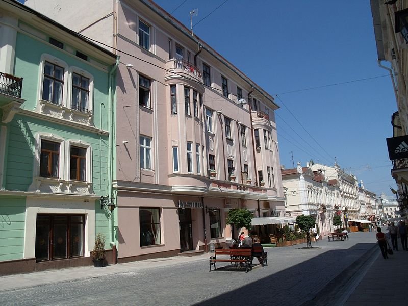
 Pedestrianized street in Chernivtsi
Source: https://commons.wikimedia.org/wiki/File:Chernivtsi_Kobylianska_18.jpg
Author: Andrewhv

Visiting Chernivtsi
You can fly to Chernivtsi from Kiev, Athens, Istanbul and Naples. There are also trains to Chernivtsi from within Ukraine as well as from Romania.Sights & Attractions in Chernivtsi
- Chernivtsi Drama Theater
Historic building built in 1905 - Chernivtsi Synagogue
Synagogue in the Moorish Revival style, badly damaged by fire during the Second World War in 1941 and since then restored. - Chernivtsi University
Formerly the residence of the Metropolitans of Bukovina, the building of the Chernivtsi University is today a World Heritage Site. - Regional Museum of Fine Arts
Museum exhibiting fine arts by Ukrainian artists. It is housed in the former savings bank builting completed in 1906.
 Latest updates on Penang Travel Tips
 Discover with Timothy YouTube Channel
 PG Food Channel
 Learn Penang Hokkien YouTube Channel
 SojiMart Videos
 Share your travels and/or ask a travel-related question
Join the Penang Travel Tips Facebook Group to share photos, tips and anything related to your travels, or ask travel-related questions.
 Map of Roads in Penang
Looking for information on Penang? Use this Map of Roads in Penang to zoom in on information about Penang, brought to you road by road. Discover with Timothy
Let me take you to explore and discover Penang through my series of walking tours on YouTube. You may use these videos as your virtual tour guide. At the beginning of each video, I provide the starting point coordinates which you may key into your GPS, Google Maps or Waze, to be navigated to where I start the walk, and use the video as your virtual tour guide.Disclaimer
Please use the information on this page as guidance only. The author endeavours to update the information on this page from time to time, but regrets any inaccuracies if there be any.Latest from Discover with Timothy: Gurney Bay - what to see and do there
About this website

Hello and thanks for reading this page. My name is Timothy and my hobby is in describing places so that I can share the information with the general public. My website has become the go to site for a lot of people including students, teachers, journalists, etc. whenever they seek information on places, particularly those in Malaysia and Singapore. I have been doing this since 5 January 2003, for over twenty years already. You can read about me at Discover Timothy. By now I have compiled information on thousands of places, mostly in Peninsular Malaysia and Singapore, and I continue to add more almost every day. My goal is to describe every street in every town in Malaysia and Singapore.
Robbie's Roadmap
- Episode 1: Robbie's Journey to Financial Freedom
- Episode 2: Lost in America
- Episode 3: The Value of Money
- Episode 4: The Mentor
- Episode 5: The Thing that Makes Money
- Episode 6: The walk with a Billionaire
- Episode 7: The Financial Freedom Awakening
- Episode 8: Meet Mr Washington
- Episode 9: The Pizzeria Incident
Copyright © 2003-2024 Timothy Tye. All Rights Reserved.