

Kiev (Київ), Ukraine
 Go Back - Latest PENANG Sights/Streets/New Properties > Malaysia > World | Hokkien : Lessons : Dictionary | YouTube | Facebook | About Me : Contact Me
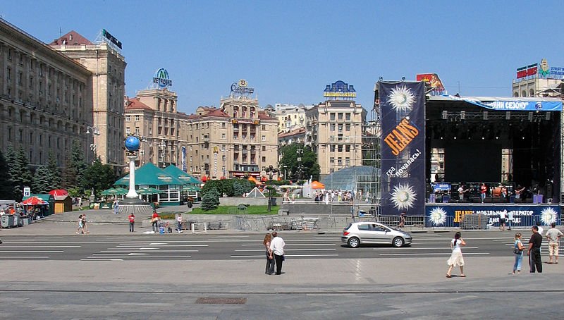 Kiev, Ukraine
Source: https://commons.wikimedia.org/wiki/File:Maidan_Nezalezhnosti.jpg
Author: BetacommandBot

Kiev (Ukrainian: Київ, Russian: Киев) is the capital and biggest city in Ukraine. It covers 839 sq km (323.9 sq mi) and has a population of 2.8 million people (2011 estimate), within a metropolitan area of 3.6 million people.
Located on the Dnieper River, Kiev is a major scientific, educational and cultural center for Eastern Europe. The city has a well-preserved Old Town with many historical landmarks. The area around Kiev has many lakes, ponds, reservoirs and rivers occupying a total of 7949 hectares of the city limits.
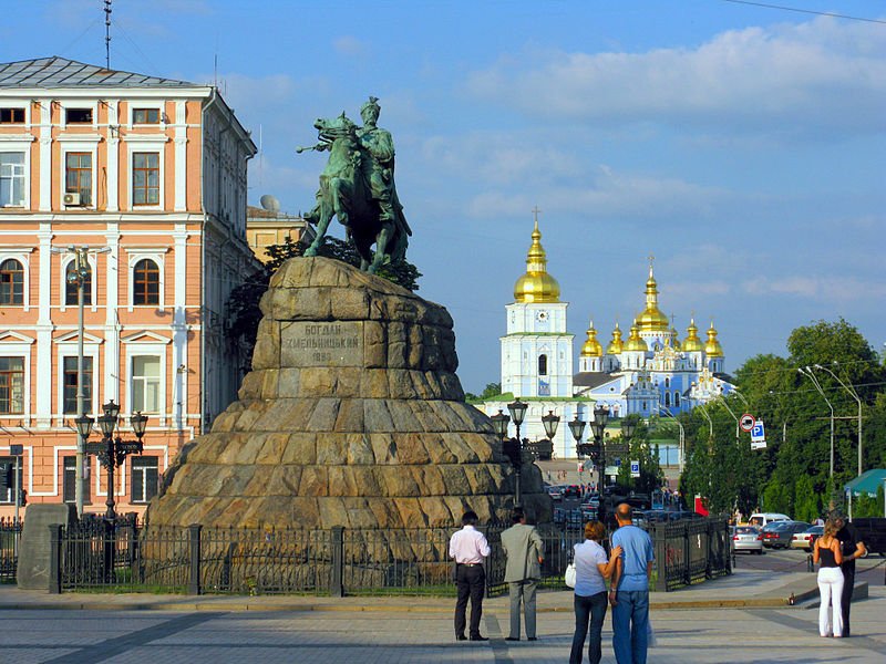 Statue of Bohdan Khmelnytsky, Kiev
Source: https://commons.wikimedia.org/wiki/File:2008_08_10_-_0837_-_Kyiv_-_Bohdan_Khmelnytsky_and_St_Michael%27s_Monastery.jpg
Author: Andrew Bossi

Kiev experiences a humid continental climate. July is the hottest month, when the average high temperature rises to 25.3°C (77.5°F). July is also the wettest month, receiving 88 mm (3.46 in) of rainfall. January is the coldest month, with average low temperature of -8.4°C (16.9°F).
Kiev is believed to be one of the oldest cities in Eastern Europe. According to legend, it was founded in AD 482 by a Slavic leader Kyi, along with his two brothers and a sister. The settlement was named Kiev, which means "belonging to Kyi". Apart from the legend, the factual evidence on the founding of Kiev is unclear.
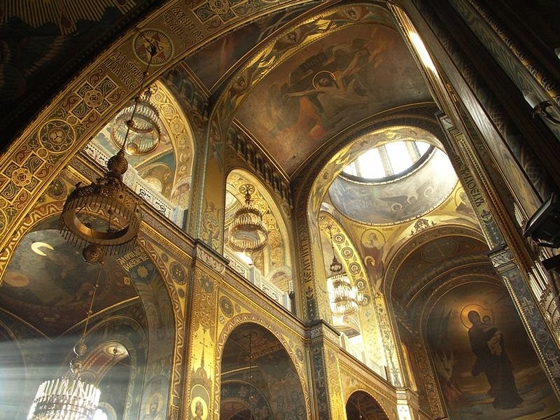 St Volodymyr's Cathedral, Kiev
Source: https://commons.wikimedia.org/wiki/File:Interior_of_St_Volodymyr%27s_Cathedral_in_Kyiv_(2).jpg
Author: Robert Broadie

Kiev was an important trade and transportation hub for the Russian Empire during the late 19th century. By the turn of the 20th century, it also developed into an industrial city. Kiev had the first electric tram line installed in 1886, making it possibly the first in the world.
Following the Russian Revolution of 1917, Kiev became capital of several shortlived states, changing hands as many as sixteen times from end 1918 to August 1920. In 1921, it became part of the Ukrainian Soviet Socialist Republic, one of the founding states of the Soviet Union. The city was severely devastated during the Second World War, and was occupied by the Nazis from September 1941 until November 1943.
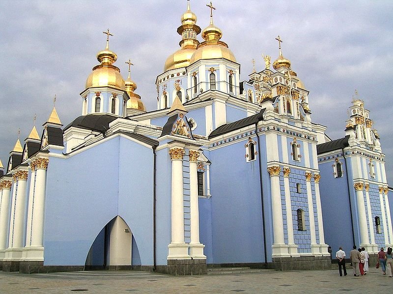 St Michael's Cathedral (Михайловский Златоверхий Собор), Kiev
Source: https://commons.wikimedia.org/wiki/File:StMichaelCathedral.jpg
Author: Alexander Noskin

In the post-war years, Kiev became the third most important city in the Soviet Union. When the Soviet Union collapsed in 1991, it became the capital of independent Ukraine. Today the city has managed to retain and preserve many of its historic buildings even as it races to modernize itself. The skyline of Kiev today is a mixture of the old and the new.
Source: https://commons.wikimedia.org/wiki/File:Iconostasis_in_St._Andrew%27s_Church.JPG
Author: Dmytro Serviyenko

Visiting Kiev
The main gateway to Kiev, and indeed to Ukraine, is the Boryspil International Airport (KRP), also written in Ukrainian as Міжнародний аеропорт "Бориспіль". The airport is located about 40 minutes from downtown Kiev. There are minibuses, called marshrutka, plying the route between the airport and the city. They take you to the main railway station for a fare of 30UAH. A taxi ride of the same journey costs 250-300UAH.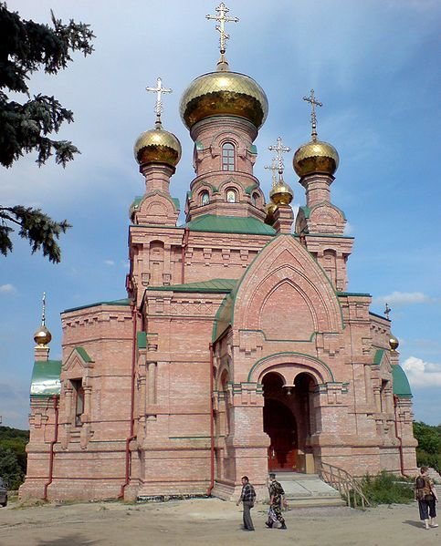 Golosiivska Pustyn Monastery, Kiev
Source: https://commons.wikimedia.org/wiki/File:Kiev_Golosiivska_Pustyn_070628.jpg
Author: Dgri

Exploring Kiev
Most of the signages in Kiev is written in Ukrainian, which uses the Cyrillic script. Few people speak any English. It may be useful to get a Russian or Ukrainian phrasebook.Sights & Attractions in Kiev
- Babyn Yar (Бабин Яр)
Ravine where the Nazis massacred 60,000 Jews, Gypsies and other civilians. - Chernobyl Museum
Museum providing details about the Chernobyl disaster. Alas nothing is in English. - Kiev Pechersk Lavra (Kiev Cave Monastery)
One of the oldest and most important monasteries in the Ukraine. It was founded by St Anthony in 1077 and comprises caves that were dug by the monks who lived there as hermits. The monks who died there were mummified. These mummies and the caves are today a tourist attraction. - Kiev TV Tower ()
The tallest lattice tower in the world, but not open to the public. - Motherland Statue
Built in 1967, it is the largest non-religious statue to be built. The Statue of Liberty is slightly taller by 2 meters, if measured including its pedestal. - Museum of Folk Architecture and Rural Life (Музей народної архітектури та побуту)
Museum providing a glimpse into rural life in the Ukraine. Covering 160 hectares, it showcases six different Ukrainian villages, complete with mills and churches, reassembled here from all over the country. - One Street Museum
Museum explaining the history of the street and its famous residents. - St Michael's Golden Domed Monastery
Still functioning monastery with a history going back to the 12th century. - St Sophia's Cathedral (Собор Святої Софії)
The oldest church in Kiev, today a World Heritage Site. - State Aviation Museum
Museum showcasing a large collection of Soviet civil and military aircraft.
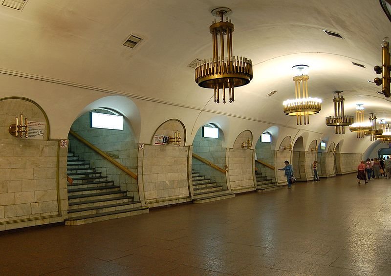 Ploscha Lva Tolstogo metro station, Kiev
Source: https://commons.wikimedia.org/wiki/File:Ploscha_Lva_Tolstogo_metro_station_Kiev_2010_04.jpg
Author: AMY 81-412

 Latest updates on Penang Travel Tips
 Discover with Timothy YouTube Channel
 PG Food Channel
 Learn Penang Hokkien YouTube Channel
 SojiMart Videos
 Share your travels and/or ask a travel-related question
Join the Penang Travel Tips Facebook Group to share photos, tips and anything related to your travels, or ask travel-related questions.
 Map of Roads in Penang
Looking for information on Penang? Use this Map of Roads in Penang to zoom in on information about Penang, brought to you road by road. Discover with Timothy
Let me take you to explore and discover Penang through my series of walking tours on YouTube. You may use these videos as your virtual tour guide. At the beginning of each video, I provide the starting point coordinates which you may key into your GPS, Google Maps or Waze, to be navigated to where I start the walk, and use the video as your virtual tour guide.Disclaimer
Please use the information on this page as guidance only. The author endeavours to update the information on this page from time to time, but regrets any inaccuracies if there be any.Latest from Discover with Timothy: Gurney Bay - what to see and do there
About this website

Hello and thanks for reading this page. My name is Timothy and my hobby is in describing places so that I can share the information with the general public. My website has become the go to site for a lot of people including students, teachers, journalists, etc. whenever they seek information on places, particularly those in Malaysia and Singapore. I have been doing this since 5 January 2003, for over twenty years already. You can read about me at Discover Timothy. By now I have compiled information on thousands of places, mostly in Peninsular Malaysia and Singapore, and I continue to add more almost every day. My goal is to describe every street in every town in Malaysia and Singapore.
Robbie's Roadmap
- Episode 1: Robbie's Journey to Financial Freedom
- Episode 2: Lost in America
- Episode 3: The Value of Money
- Episode 4: The Mentor
- Episode 5: The Thing that Makes Money
- Episode 6: The walk with a Billionaire
- Episode 7: The Financial Freedom Awakening
- Episode 8: Meet Mr Washington
- Episode 9: The Pizzeria Incident
Copyright © 2003-2024 Timothy Tye. All Rights Reserved.