
Joshua Tree National Park, California
 Go Back - Latest PENANG Sights/Streets/New Properties > Malaysia > World | Hokkien : Lessons : Dictionary | YouTube | Facebook | About Me : Contact Me
 The Teddy-bear cholla trees in Joshua Tree National Park, California
 http://commons.wikimedia.org/wiki/File:Cylindropuntia_bigelovii_Joshua_Tree.JPG
 Magnus Kjaergaard
Joshua Tree National Park is a national park straddling San Bernardino and Riverside counties in southeastern California. The park, which covers 1,234 sq mi (319,598 ha), is slightly larger than Rhode Island. Over half the area - some 429,690 acres (173,890 ha) - is designated a wilderness area.
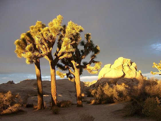
Joshua Tree National Park was a national monument since 1936 until its establishment as a national park on 31 October, 1994. It is named after the Joshua Tree (Yucca brevifolia) which is the most significant flora of the park. The climate at the national park is slightly drier and cooler than the Mojave Desert, making it ideal for Joshua trees.
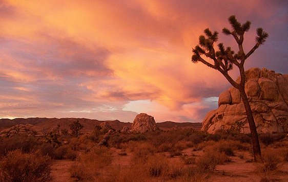
 Sunrise at Hidden Valley campground, Joshua Tree National Park
 http://commons.wikimedia.org/wiki/File:Joshua_Tree_NP_-_Sunrise.jpg
 Jarek Tuszynski
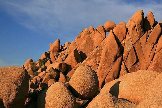
One of the attractions of Joshua Tree National Park is its hills of bare rocks. These hills have become a popular place for rock climbing and scrambling. The open expanse of the national park is forested with the Joshua trees, which do not grow close together, but far apart. Within the rocky areas are other plants such as the piñon pine, the California juniper (Juniperus california) and the scrub oak.
On the eastern part of Joshua Tree National Park, below an elevation of 3,000 ft (910 m), is the Colorado Desert. The plant life in this area is slightly different from the higher elevation, comprising Creosote bush scrub, Ocotillo, desert Saltbush, Yucca and Cholla cactus. Also with Joshua Tree National Park are five natural oases, where water occurs naturally throughout the year. These oases harbor the California Fan Palm (Washingtonia filifera), the only palm native to California.
 Joshua trees at sunset, Hidden Valley Campground
 http://commons.wikimedia.org/wiki/File:Joshua_Trees_in_Joshua_Tree_NP_1.jpg
 Jarek Tuszynski
Visiting Joshua Tree National Park, California
Joshua Tree National Park is approached on Interstate 10, which runs east-west through the southern part of the national park, and California Highway 62 (Twentynine Palms Highway), which runs to the north. There are three main entrances to the park.To reach the western entrance, exit Highway 62 to Park Boulevard and continue for 5 miles to reach park entrance.
To reach the northern entrance, exit California Highway 62 at Twentynine Palms, and turn south on Utah Trail. (See Street View here) Park entrance is three miles south of the juntion.
To reach the southern entrance, exit Interstate 10 at Cottonwood Spring (See Street View here) and follow Cottonwood Spring Rd north till you reach the national park.
 Giant Marbles rock formation, Joshua Tree National Park
 http://commons.wikimedia.org/wiki/File:Giant_Marbles_in_Joshua_Tree_National_Park.jpg
 Mila Zinkova
Joshua Tree National Park is open all year round. As summers can be unbearably hot, it is best to visit in the spring and fall, when the temperature is between 85°F (29°C) and 50°F (10°C). There are three visitors centers:
Oasis Visitor Center is open year round from 8:00 am to 5:00 pm, located at park headquarters in Twentynine Palms, at the junction of Utah Trail and National Park Drive. The Joshua Tree Visitor Center, also open 8:00 am to 5:00 pm all year, is one block south of Highway 62 on Park Boulevard in Joshua Tree Village. The Cottonwood Visitor Center is open 9:00 am to 3:00 pm year round, located 8 miles north of the interchange between Interstate 10 and Cottonwood Spring Rd.
Entrance fee for private vehicles is $15, valid for 7 days. Visitors entering on foot, bicycle, motorcycle or horse pay $5 valid for 7 days.
 Great Burrito Wall, Real Hidden Valley, Joshua Tree National Park
 http://commons.wikimedia.org/wiki/File:Joshua_Tree_-_Great_Burrito_Wall.jpg
 Jarek Tuszynski
List of National Parks in the United States
 Latest updates on Penang Travel Tips
 Discover with Timothy YouTube Channel
 PG Food Channel
 Learn Penang Hokkien YouTube Channel
 SojiMart Videos
Latest from Discover with Timothy: Gurney Bay - what to see and do there
About this website

Hello and thanks for reading this page. My name is Timothy and my hobby is in describing places so that I can share the information with the general public. My website has become the go to site for a lot of people including students, teachers, journalists, etc. whenever they seek information on places, particularly those in Malaysia and Singapore. I have been doing this since 5 January 2003, for over twenty years already. You can read about me at Discover Timothy. By now I have compiled information on thousands of places, mostly in Peninsular Malaysia and Singapore, and I continue to add more almost every day. My goal is to describe every street in every town in Malaysia and Singapore.
Robbie's Roadmap
- Episode 1: Robbie's Journey to Financial Freedom
- Episode 2: Lost in America
- Episode 3: The Value of Money
- Episode 4: The Mentor
- Episode 5: The Thing that Makes Money
- Episode 6: The walk with a Billionaire
- Episode 7: The Financial Freedom Awakening
- Episode 8: Meet Mr Washington
- Episode 9: The Pizzeria Incident
Copyright © 2003-2024 Timothy Tye. All Rights Reserved.