
Saguaro National Park, Arizona
 Go Back - Latest PENANG Sights/Streets/New Properties > Malaysia > World | Hokkien : Lessons : Dictionary | YouTube | Facebook | About Me : Contact Me
Saguaro National Park was established as the Saguaro National Monument on 1 March, 1933. It became a national park on 14 October, 1994. The park area covers 91,440 acres (37,000 hectares). Of this, 70,905 acres (28,694 ha) is designated a national wilderness area. Each section of Saguaro National Park has its own visitor center.
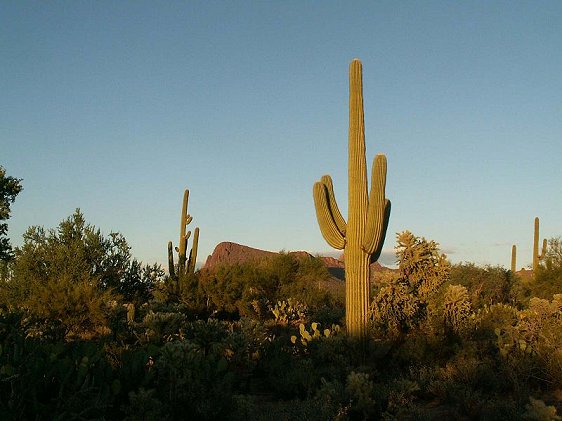
 Saguaro National Park, Arizona
 http://commons.wikimedia.org/wiki/File:Old-Saguaros-inside-the-Saguaro-National-Park-Arizona.jpg
 Jörn Napp
Saguaro National Park encompasses well-preserved part of the Sonoran Desert, along with some hill ranges, the Tucson Mountains in the western park and Rincon Mountains in the eastern park.
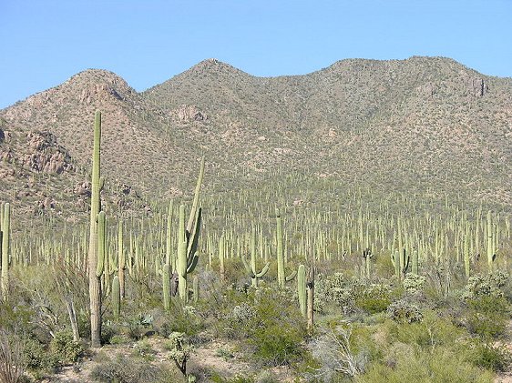
Saguaro National Park was named after the Saguaro cactus (Carnegiea gigantea) which can be found growing abundantly in the park. It is by no means the only cactus found in the national park. Other types of cacti also growing abundantly in the national park include the barrel cactus, cholla cactus and prickly pear.
Saguaro National Park is home to many types of animals including the endangered Lesser Long-nbosed Bat and the threatened Mexican Spotted Oil.
 Saguaro cacti at Saguaro National Park
 http://commons.wikimedia.org/wiki/File:Saguaro_Arizona_USA..jpg
 jay galvin
Visiting Saguaro National Park, Arizona
To East District ParkFrom Tucson, travel east on E. Broadway or E. Speedway Boulevard until S. Freeman Road. Turn right and continue south on S. Freeman Road until junction with Old Spanish Trail. Continue south on Old Spanish Trail until you reach the park entrance on the left side of the road.
To West District Park
From Tucson, travel west on W. Speedway Boulevard. After the junction with Camino de Oeste, continue on Gates Pass Road. Follow it as it winds along, until junction with Kinney Road. Turn right on Kinney Road and drive another 3 miles (5 km) to reach the park entrance, on the left side of Kinney Road.
List of National Parks in the United States
 Latest updates on Penang Travel Tips
 Discover with Timothy YouTube Channel
 PG Food Channel
 Learn Penang Hokkien YouTube Channel
 SojiMart Videos
Latest from Discover with Timothy: Gurney Bay - what to see and do there
About this website

Hello and thanks for reading this page. My name is Timothy and my hobby is in describing places so that I can share the information with the general public. My website has become the go to site for a lot of people including students, teachers, journalists, etc. whenever they seek information on places, particularly those in Malaysia and Singapore. I have been doing this since 5 January 2003, for over twenty years already. You can read about me at Discover Timothy. By now I have compiled information on thousands of places, mostly in Peninsular Malaysia and Singapore, and I continue to add more almost every day. My goal is to describe every street in every town in Malaysia and Singapore.
Robbie's Roadmap
- Episode 1: Robbie's Journey to Financial Freedom
- Episode 2: Lost in America
- Episode 3: The Value of Money
- Episode 4: The Mentor
- Episode 5: The Thing that Makes Money
- Episode 6: The walk with a Billionaire
- Episode 7: The Financial Freedom Awakening
- Episode 8: Meet Mr Washington
- Episode 9: The Pizzeria Incident
Copyright © 2003-2024 Timothy Tye. All Rights Reserved.