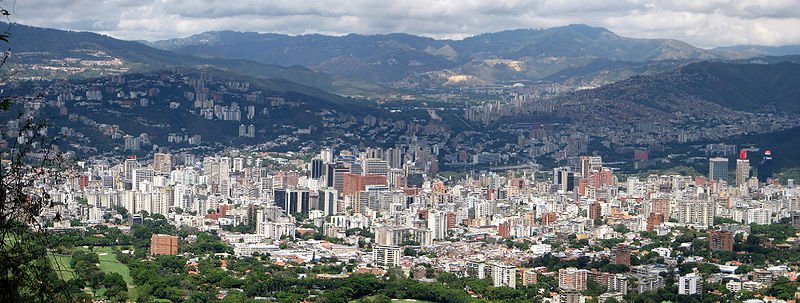
 Caracas, viewed from Mount Avila
Source: https://commons.wikimedia.org/wiki/File:CaracasAvila.jpg
Author: SuperHercules

Caracas is the capital and biggest city in Venezuela. Its official name is Santiago de León de Caracas. The city is located on the northern coast of the country. It covers 1,930 sq km (745.2 sq mi) and has a population of 1.8 million people (2011 estimate), within a metropolitan area of 5.2 million people. Caracas observes the Venezuela Standard Time, which is hour and a half hours behind Coordinated Universal Time (UTC-4:30). The phone area code for Caracas is 212.
Caracas occupies a valley in the Venezuelan coastal mountain range. The city is on an elevation ranging from 760 m (2,493 ft) to 1,043 m (3,422 ft). The Old Town is at an elevation of 900 m (2,954 ft). Separating Caracas from the coast, about 15 km to the north, is El Ávila National Park.
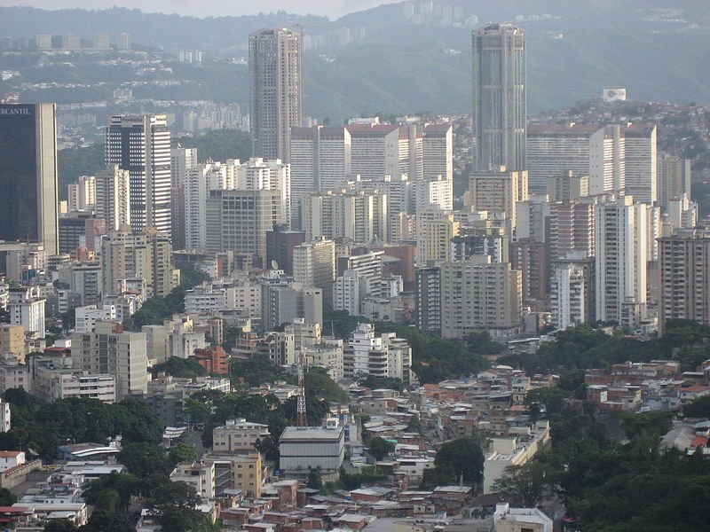 Caracas, Venezuela
Source: https://commons.wikimedia.org/wiki/File:Caracas_dec.JPG
Author: Muka

The climate of Caracas is classified as tropical savanna. Temperature is fairly constant throughout the year, the average high is around 30.3°C (86.5°F) while the average low is around 16°C (60.8°F). Rain is heaviest in June, which receives 134 mm (5.28 in) of precipitation.
The Caracas area was inhabited by indigenous people when the Spanish arrived there over four hundred years ago. The city was founded on 25 July, 1567 by Captain Diego de Losada. The city was placed away from the coast which was then vulnerable to pirate raids. Nevertheless Caracas was attacked once, in the 1680's, when buccaneers penetrated the pass and enter the town, which they then ransacked and burned.
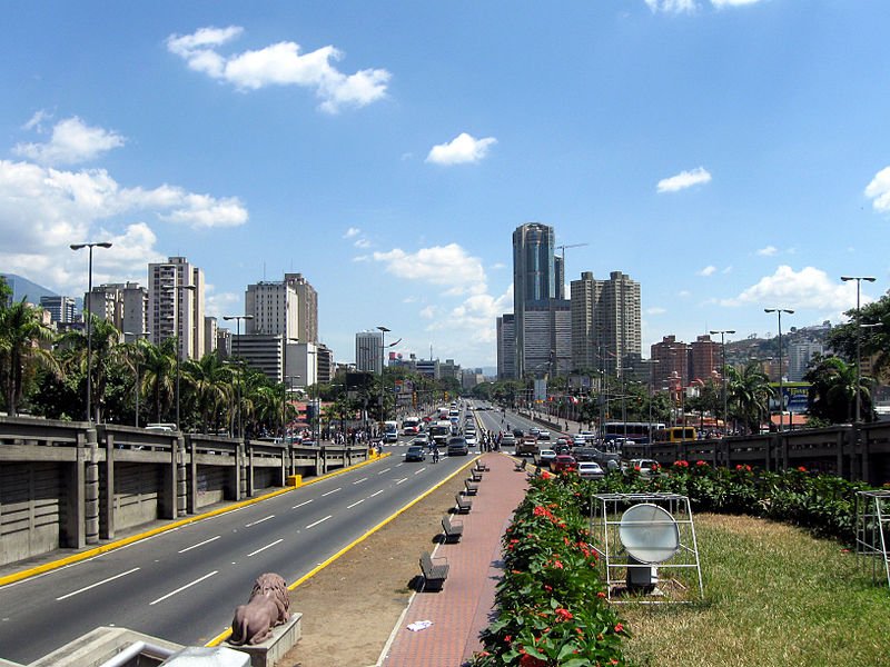 Avenida Bolívar, Caracas
Source: https://commons.wikimedia.org/wiki/File:Av_Bolivar_caracas2.jpg
Author: Erik Cleves Kristensen

Caracas was made the capital of the Captaincy General of Venezuela in 1777. Inspired by the French Revolution and the American Wars of Independence, the people of Venezuela declared their independence in Caracas on 5 July, 1811. However the Spanish crown did not accept the declaration, resulting in a war of independence which continued until 1821, when the independence fighters under Simón Bolívar won against the royalist.
Caracas modernized rapidly in the 20th century, its growth fueled by oil wealth. On the other hand, there is a gulf in income disparity between the middle3 class and the low-income working class, which creates a belt of slums, called rancho, in the city. These are populated by the rural poor who come to the city in search of better opportunities.
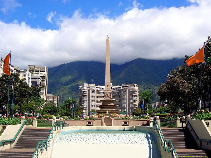 Plaza Francia, Caracas
Source: https://commons.wikimedia.org/wiki/File:Plaza_Francia.jpg
Author: Duncharris

Visiting Caracas, Venezuela
The main airport is the Simón Bolívar Airport, located in Maiquetía, 25 km from downtown Caracas. The taxi fare to Caracas is BcF 150 (which at the official - and inflated - exchange rate, comes to US$70).Exchanging money can be a big hassle in Venezuela due to exchange controls implemented by the government since 2003. Exchanges must be done at official exchange houses (called casa de cambio) or banks following a fixed official rate. It is not possible to exchange money at hotels.
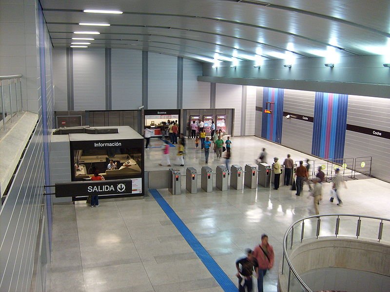 Estacion Coche, Caracas Metro
Source: https://commons.wikimedia.org/wiki/File:Estacion_Coche_L3_METRO_DE_CARACAS.JPG
Author: HARIDAS MEDEROS OCANDO

Places of Interest in Caracas, Venezuela
- Caracas Cathedral
- Caracas East Park
- Federal Capitol of Venezuela
- National Pantheon of Venezuela
- Parque Central Complex
- Plaza Bolívar
- Plaza Caracas
- Plaza San Jacinto
- Plaza Venezuela
- Simón Bolívar birthplace
- Teresa Carreño Cultural Complex
 Latest updates on Penang Travel Tips
 Discover with Timothy YouTube Channel
 PG Food Channel
 Learn Penang Hokkien YouTube Channel
 SojiMart Videos
Latest from Discover with Timothy: Gurney Bay - what to see and do there
About this website

Hello and thanks for reading this page. My name is Timothy and my hobby is in describing places so that I can share the information with the general public. My website has become the go to site for a lot of people including students, teachers, journalists, etc. whenever they seek information on places, particularly those in Malaysia and Singapore. I have been doing this since 5 January 2003, for over twenty years already. You can read about me at Discover Timothy. By now I have compiled information on thousands of places, mostly in Peninsular Malaysia and Singapore, and I continue to add more almost every day. My goal is to describe every street in every town in Malaysia and Singapore.
Robbie's Roadmap
- Episode 1: Robbie's Journey to Financial Freedom
- Episode 2: Lost in America
- Episode 3: The Value of Money
- Episode 4: The Mentor
- Episode 5: The Thing that Makes Money
- Episode 6: The walk with a Billionaire
- Episode 7: The Financial Freedom Awakening
- Episode 8: Meet Mr Washington
- Episode 9: The Pizzeria Incident
Copyright © 2003-2024 Timothy Tye. All Rights Reserved.


 Go Back