
Jiuzhaigou
 Go Back - Latest Sichuan Province > China > Asia > World | YouTube : Facebook | About Me : Contact Me
 Jiuzhaigou, Sichuan Province (17 October, 2005)
Jiuzhaigou is one of the most scenic places in China. It is located in the Jiuzhaigou Valley in Sichuan Province, and was recognized as a World Heritage Site in 1992. The heritage core zone covers an area of 72,000 hectares of forestland. On this page, I want to provide you a comprehensive guide to this beautiful part of China and all the sights in it.
Jiuzhaigou, which means "Valley of Nine Villages", is regarded as one of the most beautiful place in China. This nature reserve is located on the north of Sichuan province in central China, bordering on Tibet. Since becoming a World Heritage Site in 1992, Jiuzhaigou has become China's biggest landscape destinations, this despite having one of the highest entrance fees of any parks in China. During peak travel season in October, the park is crowded with domestic tourists, undeterred by the remoteness, long journey, and by one of the highest entrance fees in China. Travellers keen to visit Jiuzhaigou are advised to book early to avoid disappointment, as hotel rooms as hard to come by during the peak travel period.
World Heritage Site Inscription Details
Location: N33 05 E103 55Inscription Year: 1992
Type of Site: Natural
Inscription Criteria: VII
Sights in Jiuzhaigou
Jiuzhaigou is a very beautiful place in China. To help you appreciate its beauty, I have compiled the photos I took of Jiuzhaigou to make it easier for you to go through them. I hope you will enjoy this photo essay.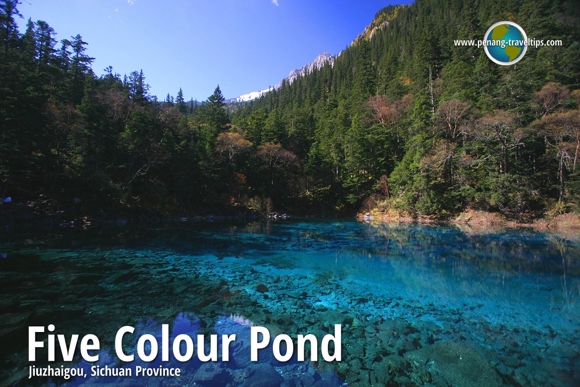
Five Colour Pond 五彩池
Details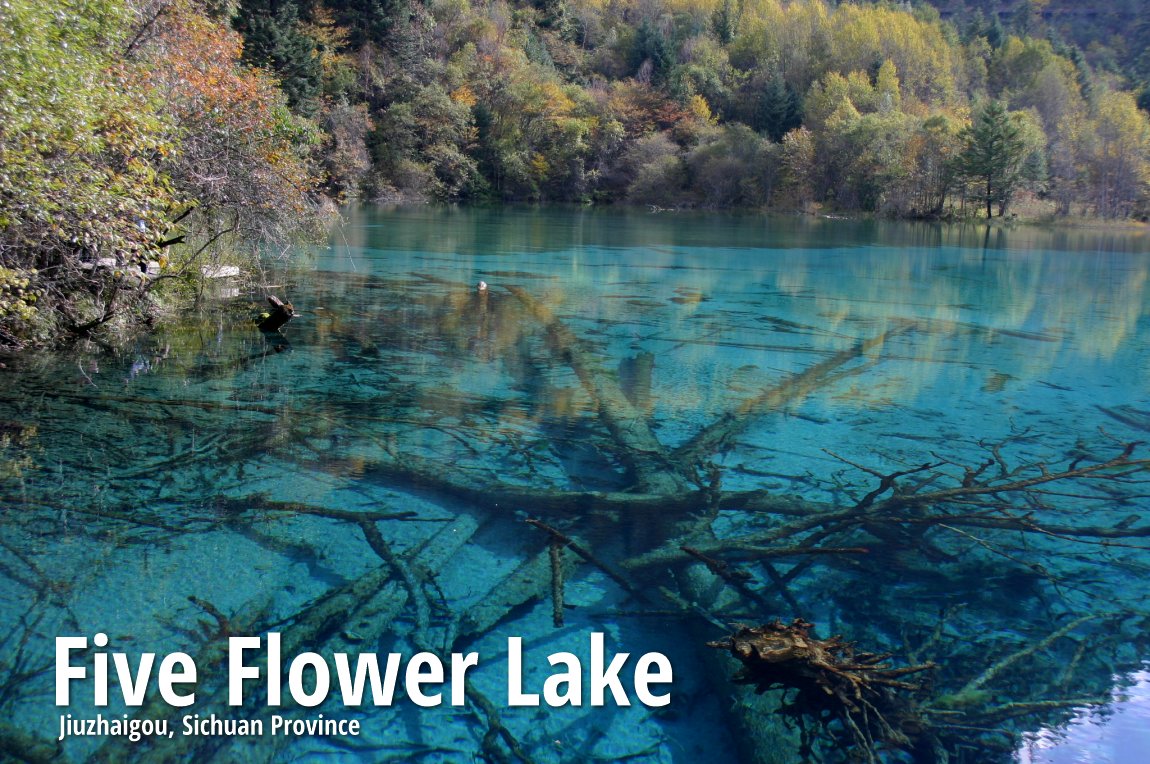
Five Flower Lake 五花海
Details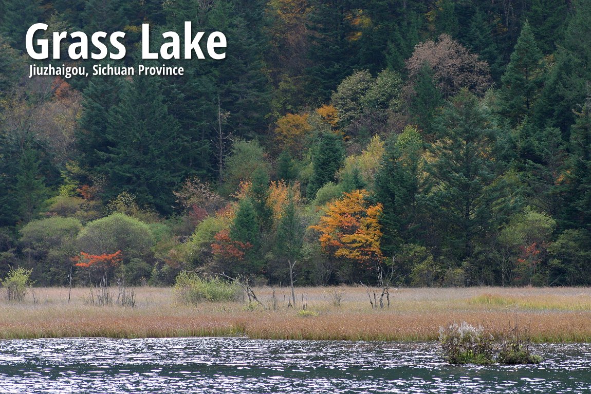
Grass Lake 草海
Details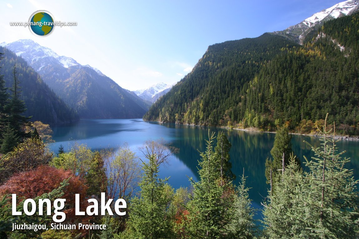
Long Lake 长海
Details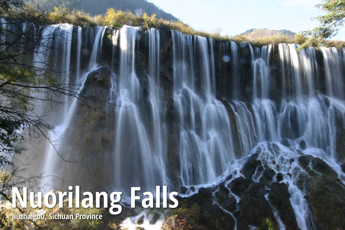
Nuorilang Waterfall 诺日朗瀑布
Details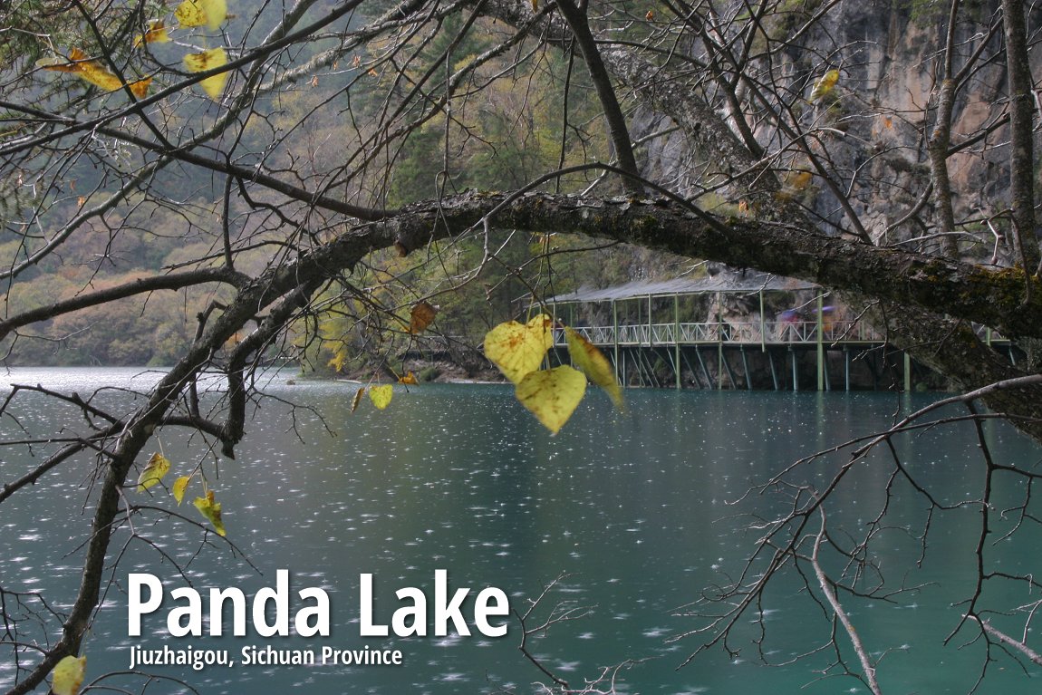
Panda Lake 熊猫海
Details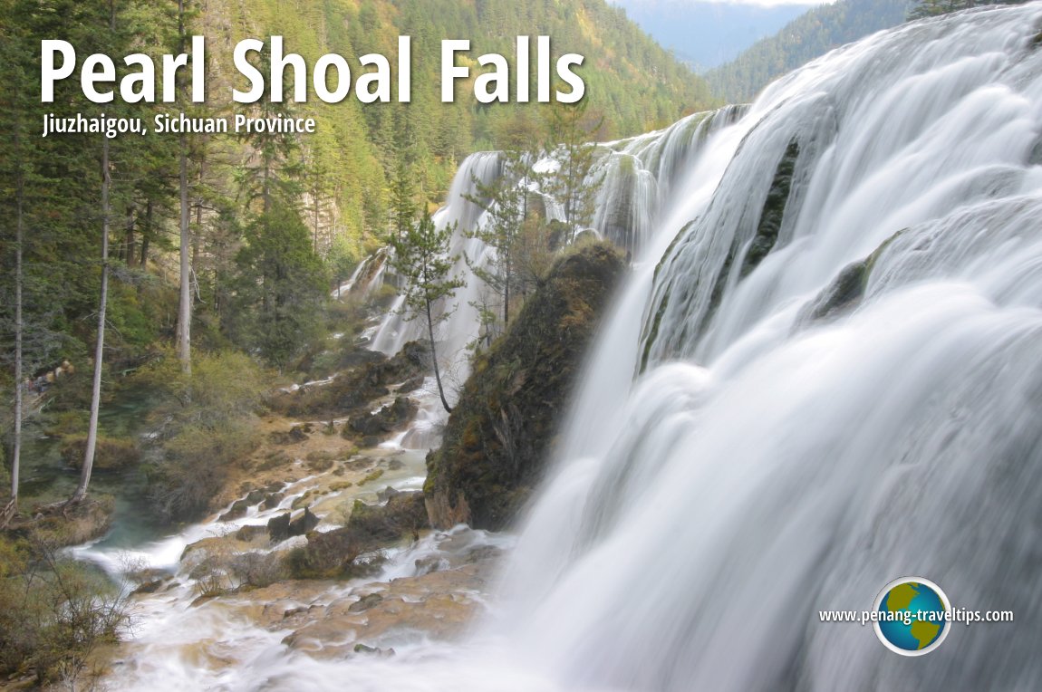
Pearl Shoal Waterfall 珍珠滩
Details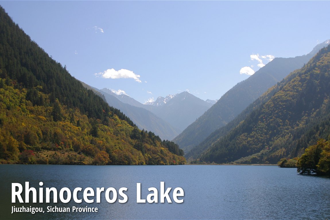
Rhinoceros Lake 犀牛海
Details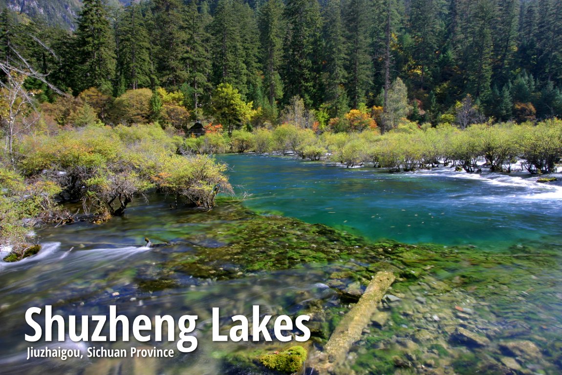
Shuzheng Lakes 树正群海
Details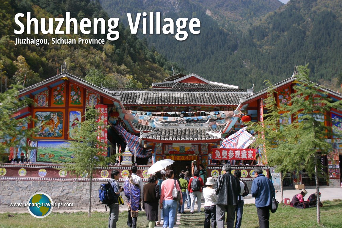
Shuzheng Village
Details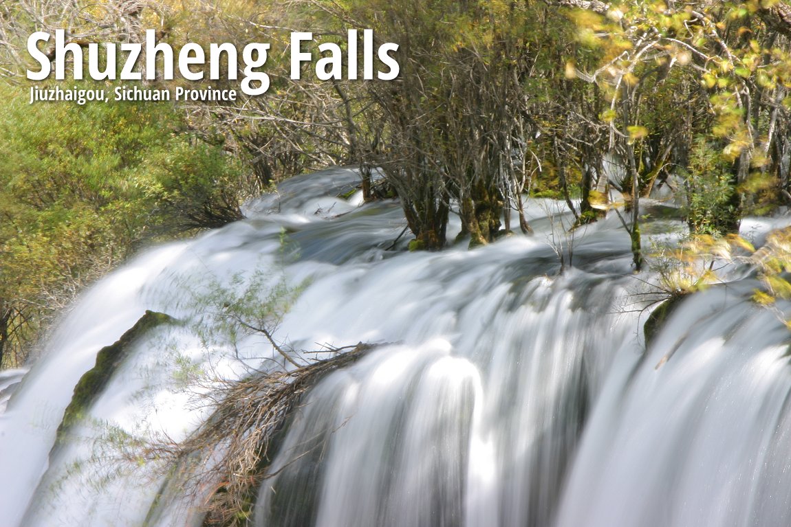
Shuzheng Waterfall
Details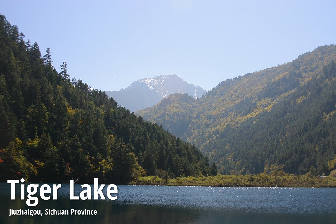
Tiger Lake 老虎海
DetailsLocation of Jiuzhaigou
Jiuzhaigou is located at the southern end of the Minshan mountain range, in Jiuzhaigou County (formerly Nanping County) in the Aba Tibetan Qiang Autonomous Prefecture of northwestern Sichuan province, near the Gansu border. The provincial capital, Chengdu, is (depending on some accounts) 330-460 km south.The Jiuzhaigou area covers 600 to 720 sq km, of which at least 240 sq km is the valley, and the remainder are buffer zones. The altitude of Jiuzhaigou ranges from 1,998 to 2,140 m, at the mouth of Shuzheng Gully, to 4,558 - 4,764 m on Mount Ganzigonggai at the top of Zechawa Gully. Jiuzhaigou enjoys a mean annual temperature of 7.2°C, with means of -1°C in January and 17°C in July. Total annual rainfall is 661 mm, of which 80% occurs between May and October.
The Discovery of Jiuzhaigou
Although Tibetans and Qiang people have inhabited Jiuzhaigou for centuries, the scenic valley was only "accidentally discovered" in 1972 when a Chinese lumberman stumbled upon it. Logging continued to take place in Jiuzhaigou until 1979, when the Chinese government banned it. In 1982, Jiuzhaigou was made a national park. An Administration Bureau was established and the site was officially opened to tourism in 1984. From then on, tourism in Jiuzhaigou took flight, and Jiuzhaigou quickly became China's number one landscape destination. Its status was further propelled forward when UNESCO inscribed it as a World Heritage Site in 1992 and a World Biosphere Reserve in 1997.Since the Jiuzhaigou Scenic Park opened its doors to paying visitors in 1984, the number of tourists entering Jiuzhaigou has taken several quantum leaps, in tandem with China's growing middle class. From just 5000 visitors in 1984, the number ballooned to over 100,000 visitors in the 90's. By the 2002 calendar year, the total number of visitors has exceeded a million, reaching 1,190,000.
To preserve Jiuzhaigou for the future, and to halt environmental degradation, a quota of 12,000 visitors per day was imposed during high season. As of 2004, Jiuzhaigou receives an average of 7,000 visitors per day. Visitors to Jiuzhaigou are no longer allowed to stay overnight inside the park, and have to find accommodation outside the gates. The township of Zhangzha at the entrance to the Jiuzhaigou valley sprout numerous hotels and resorts to receive this human tide that engulfs Jiuzhaigou annually.
The original inhabitants of Jiuzhaigou
Jiuzhaigou derives its name from the nine Tibetan hamlets that ran along its length. Only traces of them remain today, depending on what you would regard as a "village within a valley". These include Heyezhai, Shuzhengzhai and Zechawazhai along the gully, plus Rexi and Heijiao in the smaller Zaru Gully. At the opposite end of Zaru Gully are the villages of Jianpan, Panya and Guwa. Finally, along the road that passes through the town of Jiuzhaigou/Zhangza outside the valley are the villages of Penbu, Panxing and Yongzhu. The population of Jiuzhaigou valley was about 1000 in 1991, consisting of about 130 Tibetan and Qiang families. Since then, the government has relocated them outside the park area, to reduce environmental damage due to human habitation. Tourism has replaced agricultural activities - which is now effectively forbidden within the park limits.What makes Jiuzhaigou unique
Why do so many people come to Jiuzhaigou, and what makes it so unique? Most visitors would agree that a major draw is the beautiful colour of the lakes and streams. This is caused by the high concentration of travertine, or calcium carbonate in the water.As Jiuzhaigou consists of temperate broad-leaf forest and woodlands, the trees take on a multi-colour hue of yellow, orange and red during autum, making it the prime travel period. In addition to the maple trees that provide a riot of autumn colours, Jiuzhaigou is also home to several varieties of rhododendron and bamboo endemic to the area.
The wildlife of Jiuzhaigou includes the endangered giant panda and the golden snub-nosed monkey, both of which facing increasing pressure brought on by tourism. Approximately 140 species of birds are also found in Jiuzhaigou.
How Jiuzhaigou was formed
The landscape of Jiuzhaigou comprises high-altitude karsts shaped by glacial, hydrological and tectonic activity. Jiuzhaigou lies on major faultlines between the Qinghai-Tibet Plate and the Yangtze Plate. The rock strata is mostly made up of carbonate rocks such dolomite and tufa, as well as some sandstone and shales. The Jiuzhaigou valley includes the catchment area of three gullies. Due to their large size, they are often regarded as valleys themselves. The gullies are sources of the Jialing River, part of the Chang Jiang River system. The most distinctive feature of Jiuzhaigou are its many blue, green and turquoise-colored lakes. These lakes are the result of glacial activity. Some of these lakes have a high concentration of travertine, or calcium carbonate deposits and sediments. Their water is very clear so that the bottom is often visible even at high depths. The lakes vary in color according to their depths, residues, and surroundings. It is strictly forbidden for tourists to be in direct contact with the lakes.Geography of Jiuzhaigou
Jiuzhaigou is composed of three valleys arranged in a Y. The Rize and Zechawa gullies flow from the south and meet to form Shuzheng gully, which flows north to the mouth of the valley. Most maps of Jiuzhaigou will however show you the valley "upside down", with north at the bottom. The gullies are lined with 55 km of roads for shuttle buses, as well as boardwalks and pavilions.The Gullies of Jiuzhaigou
- Shuzheng Gully is the northern (or main) branch of Jiuzhaigou Valley. It has a length of 14.5 km from the Y-shaped intersection of the three gullies.
- Rize Gully is 18 km long. It forms the south-western fork of Jiuzhaigou. Rize Gully contains the largest variety of sites and is typically visited first. Going downhill from its highest point, one passes the following sites:
- Zechawa Gully is the south-eastern fork of Jiuzhaigou. Like Rize Gully, it is also about 18 km but climbs to a higher altitude - 3150 m at Long Lake.
Rize Gully
Going downhill from the highest point in Rize Gully, you pass the Primeval Forest, a well-preserved woodland fronted by spectacular views of the surrounding mountains and cliffs, including the 500 m high blade-shaped rock called Sword Rock. Further down, you come to Swan Lake, a 2250 m long, 125 m wide picturesque lake named after visiting swans and ducks. At the bottom of it is Pearl Shoal Falls.The Lakes of Jiuzhaigou
There are many picturesque lakes in Jiuzhaigou. Many of these lakes are called "sea" because, to the original Tibetan inhabitants, these are as close to a true sea as it gets. Some of these lakes are described below:- Long Lake (Chang Hai) is the highest, largest and deepest lake in Jiuzhaigou. Long Lake measures 7.5 km in length and up to 103 m in depth. Long Lake reportedly has no outgoing waterways. It gets its water from snowmelt and loses it from seepage. According to local folklore, a monster inhabits its depths.
- Grass Lake (Cao Hai) is a shallow lake covered in river grass.
- Arrow Bamboo Lake (Jianzhu Hai) covers an area of 170,000 sq meter. It has a depth of 6 m and lies at an elevation of 2,618 m. Arrow Bamboo Lake was a main feature site for the 2002 Chinese film Hero.
- Panda Lake (Xiongmao Hai) features beautiful patterns of blue and green. It empties into the multi-stream, multi-level Panda Waterfalls, which drop 78m in 3 steps.
- Five Flower Lake (Wuhua Hai) is a shallow multi-colored lake whose bottom is criss-crossed by ancient fallen tree trunks.
- Mirror Lake (Jing Hai) is another quiet lake casting beautiful reflections of the surroundings when the water is calm.
- Nuorilang Lakes (Nuorilang Qunhai) and Shuzheng Lakes (Shuzheng Qunhai) are stepped series of 18 and 19 ribbon lakes formed by the passage of glaciers. Some of them have their own folkloric names, such as Rhinoceros Lake, Unknown Lake, and Tiger Lake.
- Sleeping Dragon Lake (Wolong Hai) is one of the lower lakes in the area. With a depth of 20 m, it is notable for the calcareous dyke running through it, whose shape has been compared to a dragon lying on the bottom.
- Reed Lake (Luwei Hai) is a 1375m-long, reed-covered marshland with a clear brook flowing through it. Reed Lake is particularly striking in the autumn when the reeds turn yellow.
The Ponds of Jiuzhaigou
- Five-Colour Pond (Wucai Chi) is one of the smallest but most spectacular bodies of water in Jiuzhaigou lakes. Five-Colour Pond is richly colored with some of the brightest and clearest waters in Jiuzhaigou.
- Seasonal Lakes (Jijie Hai) are a series of 3 lakes (Lower, Middle and Upper) along the main road. These lakes dry up during some parts of the year.
The Waterfalls of Jiuzhaigou
- Pearl Shoal Falls (Zhenzhu Tan) is a wide, gently sloping area of active calcareous tufa deposition covered in a thin sheet of flowing water. It empties into the beautiful Pearl Waterfalls, where the shoal drops 28 m in a 310 m wide broad curtain of water. A scene from the television adaptation of Journey to the West was filmed there.
- Nuorilang Falls (Nuorilang Pubu), near the intersection of the valleys, is 320 m wide and 20 m high. It is regarded as the widest highland waterfall in China and a landmark of Jiuzhaigou.
Other Sights in Jiuzhaigou
- Zaru Gully is a small valley that runs southeast from the main Shuzheng gully. Zaru Gully begins at the Zaru Buddhist monastery and ends with the Red, Black, and Daling lakes.
- Fairy Pool lies 42 km west of Jiuzhaigou and features travertine pools very similar to those of nearby Huanglong Natural Reserve.
Getting to Jiuzhaigou
Jiuzhaigou is notoriously difficult to access by land. For most tourist, a trip to Jiuzhaigou means a 10 hour bus journey from Chengdu along the Minjiang River gorge, where rockslides and mudslides could delay the trip for several more hours. However, of late the road has become much less perilous than before, with the completion of a new highway.Since 2003, travellers may also fly from Chengdu or Chongqing to the airport near Songpan County and then take a 2-hour bus ride to Jiuzhaigou or one hour to Huanglong. The Jiuzhaigou-Huanglong Airport (JZH) is served by flights by Air China, Sichuan Airlines, South China Airways and China Eastern. There is also a new helipad near the valley. Nevertheless, during the peak travel season of autumn, the airport is usually closed if there a slight chance of a blizzard.
Tickets into Jiuzhaigou
Entry tickets for individual travellers to Jiuzhaigou is RMB235 as of 2009, ranking it as among the most expensive for a tourist site in China. The fee includes a compulsory shuttle bus day pass - the only form of transportation in the valley as private cars are not allowed in for ecological reasons. Also included in the fare is an insurance fee of RMB 3.00. Senior citizen aged 60-70 pays only RMB170 while children below 1.3 meters in height, Chinese government servants and senior citizen above age 70 get to enter for free. Tickets are sold from 6:30 am in the morning, and is only valid for the day.List of World Heritage Sites in Sichuan Province and World Heritage Sites in China
 Latest updates on Penang Travel Tips
Discover with Timothy YouTube Channel
PG Food Channel
Learn Penang Hokkien YouTube Channel
SojiMart Videos
Share your travels and/or ask a travel-related question
Join the Penang Travel Tips Facebook Group to share photos, tips and anything related to your travels, or ask travel-related questions.
 Map of Roads in Penang
Looking for information on Penang? Use this Map of Roads in Penang to zoom in on information about Penang, brought to you road by road. Discover with Timothy
Let me take you to explore and discover Penang through my series of walking tours on YouTube. You may use these videos as your virtual tour guide. At the beginning of each video, I provide the starting point coordinates which you may key into your GPS, Google Maps or Waze, to be navigated to where I start the walk, and use the video as your virtual tour guide.Disclaimer
Please use the information on this page as guidance only. The author endeavours to update the information on this page from time to time, but regrets any inaccuracies if there be any.Latest from Discover with Timothy: Gurney Bay - what to see and do there
About this website

Hello and thanks for reading this page. My name is Timothy and my hobby is in describing places so that I can share the information with the general public. My website has become the go to site for a lot of people including students, teachers, journalists, etc. whenever they seek information on places, particularly those in Malaysia and Singapore. I have been doing this since 5 January 2003, for over twenty years already. You can read about me at Discover Timothy. By now I have compiled information on thousands of places, mostly in Peninsular Malaysia and Singapore, and I continue to add more almost every day. My goal is to describe every street in every town in Malaysia and Singapore.
Robbie's Roadmap
- Episode 1: Robbie's Journey to Financial Freedom
- Episode 2: Lost in America
- Episode 3: The Value of Money
- Episode 4: The Mentor
- Episode 5: The Thing that Makes Money
- Episode 6: The walk with a Billionaire
- Episode 7: The Financial Freedom Awakening
- Episode 8: Meet Mr Washington
- Episode 9: The Pizzeria Incident
Copyright © 2003-2024 Timothy Tye. All Rights Reserved.