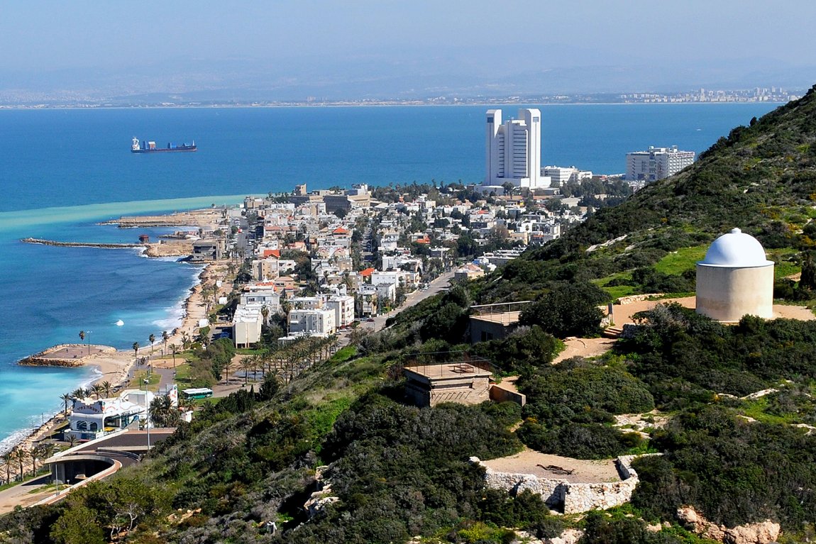
Haifa is on the coast facing the Mediterranean Sea. It is between Mount Carmel and Haifa Bay. It is about 90 km (56 mi) to the north of Tel Aviv. Haifa has a number of beaches along the Mediterranean coast. It enjoys a Mediterranean climate. The hottest months are July and August, when the average high temperature reaches 31.4°C (88.5°F). Coldest month in Haifa are January and February, when the average temperature may drop to 8.7°C (47.7°F).

View of Haifa from Mount Carmel
Source: http://commons.wikimedia.org/wiki/File:Haifa_2872-1.jpg
Author: Zvi Roger

The city of Haifa is one of the industrial centers of Israel. It is home to Matam, the largest and oldest business park in Israel, which houses facilities for a number of multi-national corporations including Intel, IBM, Microsoft and Google. The city has one of the two oil refineries in Israel. It was built in the 1930's during the British Mandate.
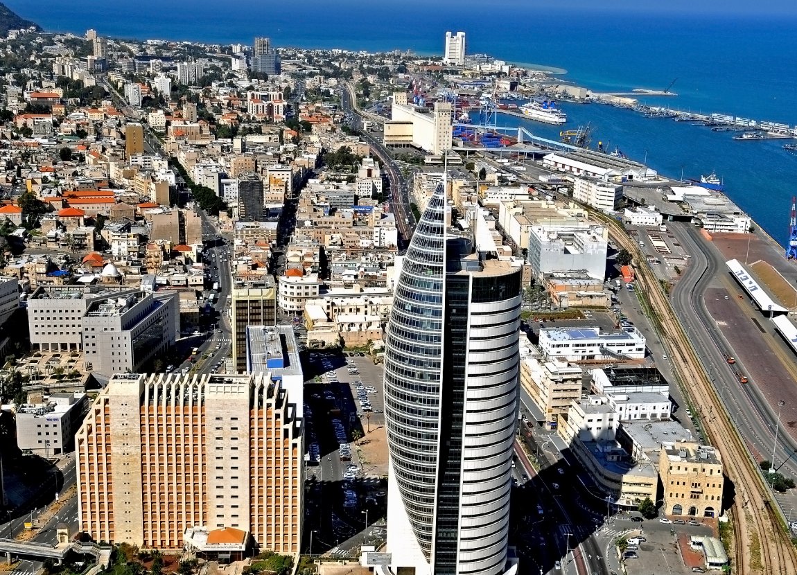
Haifa is today a modern city with its share of shopping malls and skyscrapers. It is also the site of the Bahá'í World Center, the spiritual and administrative center of the Bahá'í faith, which had its origin in the area during the Ottoman Syria period in the 19th century. Today the centre is a World Heritage Site.

Downtown Haifa, Israel
Source: http://commons.wikimedia.org/wiki/File:Haifa_2769-1.jpg
Author: Zvi Roger

The history of Haifa goes back to the 14th century BC, when a small port city existed here known as Tell Abu Hawam. That city later relocated to a different site further south, as the harbor became shallow. The city of Haifa was first mentioned in the 3rd century AD.
Over the ages, Haifa was under the rule of different powers, including the Greeks, the Byzantine, the Arabs and the Crusaders. Under the Crusaders, Haifa was reduced to a small rural village within the Principality of Galilee. In the 12th century, the Carmelites established a church on Mount Carmel.
The Arabs under Kurdish Muslim Saladin captured Haifa in 1187, destroying the Crusader's fortress in the process. Many of the houses in the city were also destroyed, as a means of preventing the Crusaders from coming back. Haifa was under Ottoman rule right through the 19th century, although the period was punctuated by brief periods when occasional foreign conquests, such as that of Napoleon Bonaparte in 1799, and the rule of Egyptian viceroy Muhammad Ali between 1831 and 1840.
Ottoman rule finally came to an end when the empire collapsed at the end of the First World War. Haifa fell to Indian horsemen serving the British Army in 1918, and with that, the city came under British Mandate. During that time, the Arab population of Haifa was 96% while the Jewish population only 4%. The figures were to invest over the decades, as the Jewish population steadily increased. Today 90% of the population are Jews, of which over a quarter were immigrants from the former Soviet Union. The remainder 10% are Arabs who are predominantly Christians.
Visiting Haifa
The Haifa U Michaeli Airport is a domestic airport receiving flights only from Eilat and Tel Aviv. Instead of flying to this airport, you can also reach Haifa by train or bus from Tel Aviv.
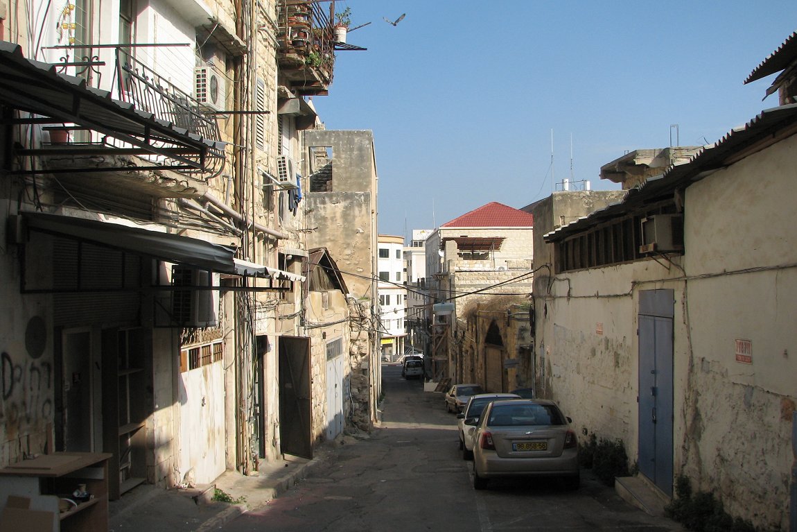
Back street in Haifa
Source: http://commons.wikimedia.org/wiki/File:Paris_Square_%E2%80%93_Hamaronitm_st.JPG
Author: Hanay

Places of Interest in Haifa
- Bahá'í Gardens and World Center
- Bat Galim
- Cave of Elijah
- German Colony
- National Museum of Science and Technology
- Stella Maris Carmelite Monastery
- University of Haifa
 Latest updates on Penang Travel Tips
 Discover with Timothy YouTube Channel
 PG Food Channel
 Learn Penang Hokkien YouTube Channel
 SojiMart Videos
 Share your travels and/or ask a travel-related question
Join the Penang Travel Tips Facebook Group to share photos, tips and anything related to your travels, or ask travel-related questions.
 Map of Roads in Penang
Looking for information on Penang? Use this Map of Roads in Penang to zoom in on information about Penang, brought to you road by road. Discover with Timothy
Let me take you to explore and discover Penang through my series of walking tours on YouTube. You may use these videos as your virtual tour guide. At the beginning of each video, I provide the starting point coordinates which you may key into your GPS, Google Maps or Waze, to be navigated to where I start the walk, and use the video as your virtual tour guide.Disclaimer
Please use the information on this page as guidance only. The author endeavours to update the information on this page from time to time, but regrets any inaccuracies if there be any.Latest from Discover with Timothy: Gurney Bay - what to see and do there
About this website

Hello and thanks for reading this page. My name is Timothy and my hobby is in describing places so that I can share the information with the general public. My website has become the go to site for a lot of people including students, teachers, journalists, etc. whenever they seek information on places, particularly those in Malaysia and Singapore. I have been doing this since 5 January 2003, for over twenty years already. You can read about me at Discover Timothy. By now I have compiled information on thousands of places, mostly in Peninsular Malaysia and Singapore, and I continue to add more almost every day. My goal is to describe every street in every town in Malaysia and Singapore.
Robbie's Roadmap
- Episode 1: Robbie's Journey to Financial Freedom
- Episode 2: Lost in America
- Episode 3: The Value of Money
- Episode 4: The Mentor
- Episode 5: The Thing that Makes Money
- Episode 6: The walk with a Billionaire
- Episode 7: The Financial Freedom Awakening
- Episode 8: Meet Mr Washington
- Episode 9: The Pizzeria Incident
Copyright © 2003-2024 Timothy Tye. All Rights Reserved.


 Go Back