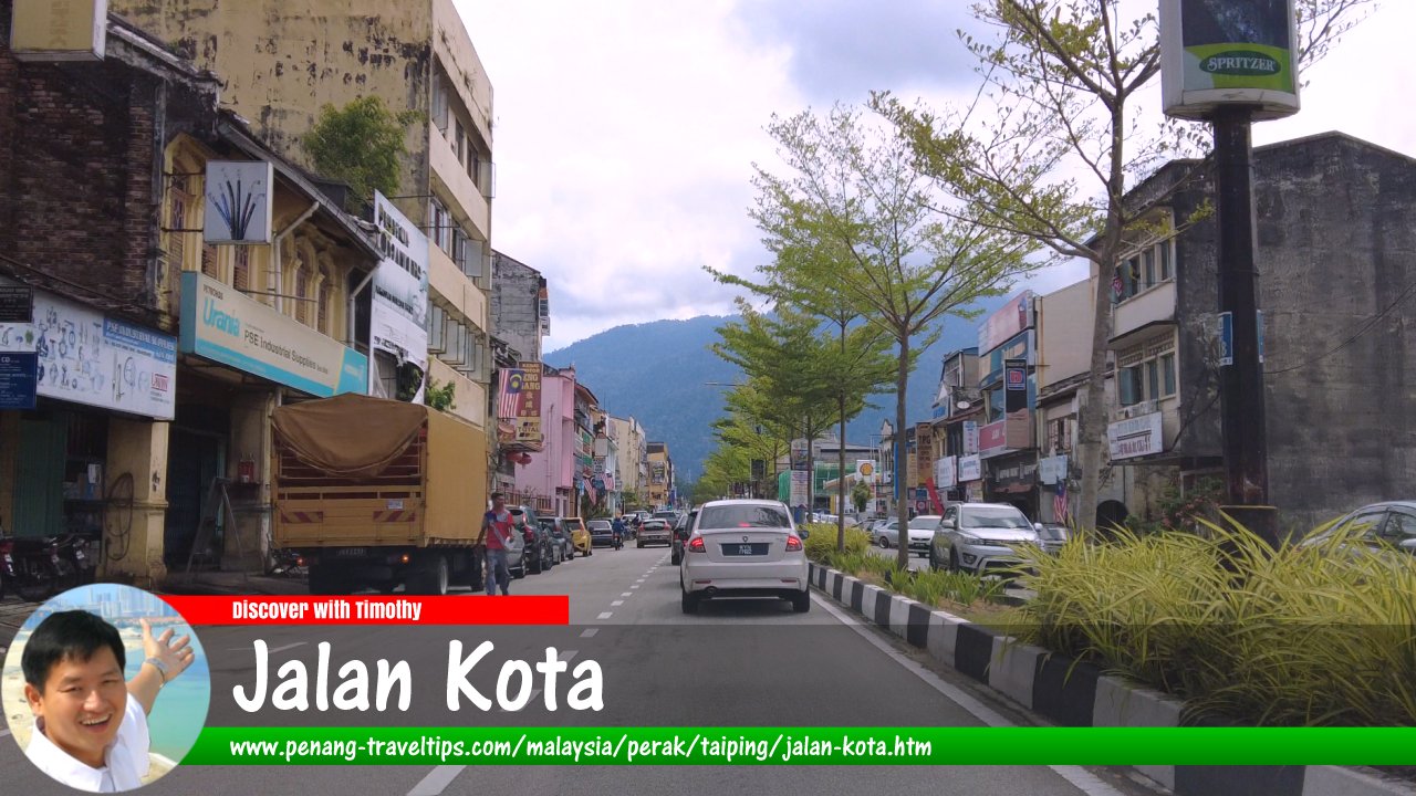
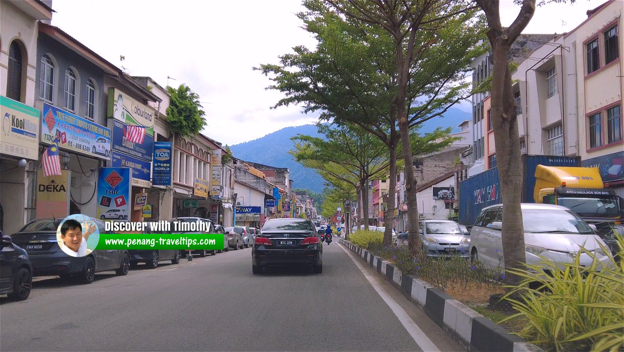
 Jalan Kota, Taiping (30 September 2022)
Jalan Kota is one of the major roads in Taiping, Perak. Formerly known as Kota Road, it starts at Jalan Sultan Mansor, at the junction with Jalan Pekeliling, in the northeast, and ends at the junction with Jalan Stesen, Jalan Taming Sari and Jalan Taiping-Kuala Sepetang, in the southwest.
Jalan Kota passes through the town centre of Taiping. It is intersected or branches to Jalan Alang Ahmad, Jalan Tokong, Jalan Manecksha, Jalan Ong Saik, Jalan Sultan Abdullah, Jalan Lim Tee Hooi, Jalan Tupai, Jalan Lim Teong Chye, Jalan Kelab Cina, Halaman Pasar, Jalan Chung Thye Phin, Jalan Iskandar, Jalan Idris and Jalan Masjid.
Map of Jalan Kota, Taiping
Sights in Jalan Kota
- 7-Eleven @ Jalan Chung Thye Phin (GPS: 4.85109, 100.7398)

- Bangunan Malaysia (GPS: 4.85263, 100.74267)

- Hock Moon Hiong Dried Meat (GPS: 4.85082, 100.74003)

- Hosian Temple (GPS: 4.84857, 100.73587)

- Hotel Panorama, Raintown Plaza (GPS: 4.85191, 100.74168)

- Inland Revenue Board of Malaysia, Wisma Hasil (GPS: 4.84763, 100.73545)

- Kedai Kopi Prima (GPS: 4.85276, 100.74289)

- KFC, Aun Chuan Hotel (GPS: 4.8512, 100.74057)

- Kompleks Mahkamah Taiping (GPS: 4.85359, 100.74423)

- Kwangtung Association of North Perak (GPS: 4.85333, 100.74373)

- Larut, Matang & Selama District & Land Office (GPS: 4.85379, 100.7436)

- McDonald's Taman Tasik (GPS: 4.8543, 100.74534)

- Old Kota Mosque (GPS: 4.84952, 100.73732)

- Pejabat Orang Besar Jajahan (GPS: 4.8474, 100.73499)

- Perpustakaan Awam Taiping / Taiping Public Library (GPS: 4.85444, 100.74466)

- Pizza Hut (GPS: 4.85135, 100.74077)

- Restoran Kamaliya Maju (GPS: 4.85222, 100.74149)

- Restoran Kum Loong (GPS: 4.85224, 100.74211)

- Restoran Nafis Kitchen, Rumah UMNO Taiping (GPS: 4.85343, 100.74316)

- Restoran Prima Taiping, Bangunan Persatuan Kaying (GPS: 4.85288, 100.74312)

- Restoran Taugeh Ayam Ta Pin (GPS: 4.85304, 100.74274)

- Shell Petrol Station (GPS: 4.84874, 100.73695)

- Siang Malam Hawker Centre (GPS: 4.85095, 100.74034)

- Sin Kuan Kee Restaurant (GPS: 4.85239, 100.74232)

- Shun Te Hui Kuan (GPS: 4.85321, 100.74302)

- Sri Nagamuthu Mariamman Temple (GPS: 4.85321, 100.74302)

- Synn Lee & Company, Rubber Dealers (GPS: 4.85006, 100.73886)

- Taiping Chinese Gospel Hall (GPS: 4.84845, 100.7366)

- Taiping Clock Tower (GPS: 4.85209, 100.74193)

- Taiping Hokkien Association (GPS: 4.84805, 100.73523)

- Taiping Market (GPS: 4.85137, 100.74005)

 Jalan Kota, Taiping (30 September 2022)
Jalan Kota on Google Street View
Jalan Kota (Jul 2020)Back to Discover Taiping, Perak mainpage; list of Streets of Taiping, Streets of Perak and Streets of Malaysia
 Latest updates on Penang Travel Tips
 Discover with Timothy YouTube Channel
 PG Food Channel
 Learn Penang Hokkien YouTube Channel
 SojiMart Videos
Latest from Discover with Timothy: Gurney Bay - what to see and do there
About this website

Hello and thanks for reading this page. My name is Timothy and my hobby is in describing places so that I can share the information with the general public. My website has become the go to site for a lot of people including students, teachers, journalists, etc. whenever they seek information on places, particularly those in Malaysia and Singapore. I have been doing this since 5 January 2003, for over twenty years already. You can read about me at Discover Timothy. By now I have compiled information on thousands of places, mostly in Peninsular Malaysia and Singapore, and I continue to add more almost every day. My goal is to describe every street in every town in Malaysia and Singapore.
Robbie's Roadmap
- Episode 1: Robbie's Journey to Financial Freedom
- Episode 2: Lost in America
- Episode 3: The Value of Money
- Episode 4: The Mentor
- Episode 5: The Thing that Makes Money
- Episode 6: The walk with a Billionaire
- Episode 7: The Financial Freedom Awakening
- Episode 8: Meet Mr Washington
- Episode 9: The Pizzeria Incident
Copyright © 2003-2024 Timothy Tye. All Rights Reserved.


 Go Back