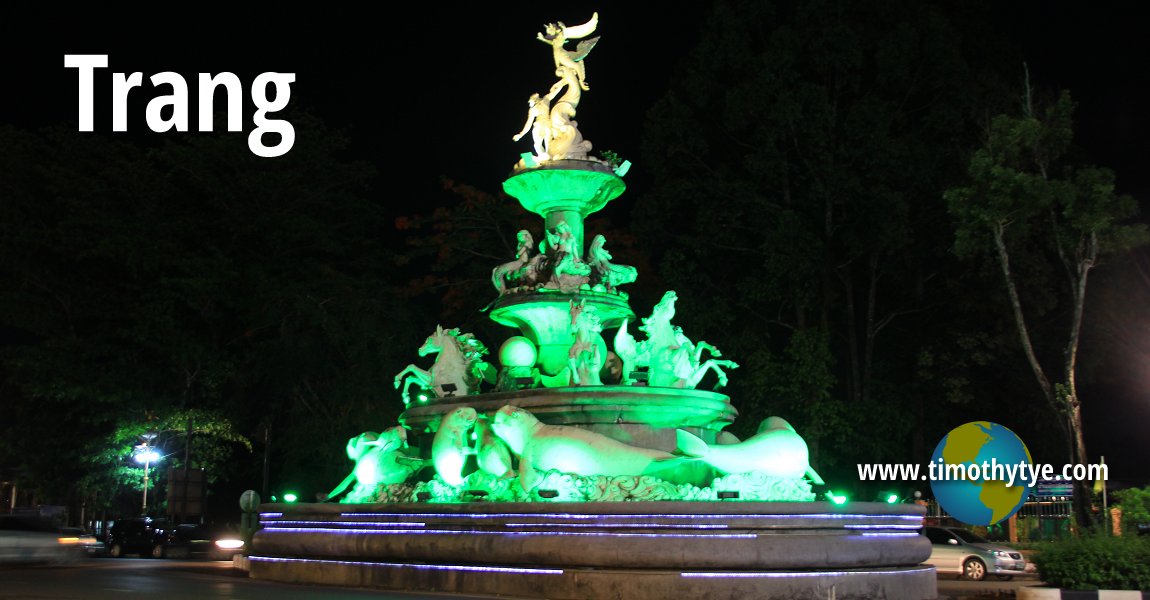
 Trang Memorial (10 May, 2014)
Trang ตรัง
 also known in full as เมืองทับเที่ยง
  is a small town in southern Thailand. The town is also the provincial capital of Trang Province. It has a population of around 60,000 people, and is one of those country towns you can find all across Thailand.
The name Trang is said to have been derived from the Malay word "terang", meaning "bright". In the days of old, seafarers can spot the lights of the Trang village to aid them in navigating their crafts to shore. The Trang River flows on the west side of town to its mouth on the Andaman Sea.
Trang was the first place where rubber was planted in Thailand. It was brought by Khaw Sim Bee, also known in Thai as Phraya Ratsadanupradit Maissara Phakdi, in 1899. Off the coast of Trang are some 46 islands, many of these being developed for tourism. Activities available here includes kayaking to explore the limestone sea caves and karst outcrops.
Map of Trang Town
Sights in Trang Town
- Rua Rasada Hotel (GPS: 7.5647, 99.63092)

- Trang Night Market (GPS: 7.55856, 99.61225)

Travel to Trang
You can reach Trang by bus from Hatyai, Satun, Surat Thani and Phuket. You can also take the train from Bangkok to Trang. The train journey takes at least 15 hours.Travel within Trang
The ubiquitous tuk tuk (motorised tricycles) is the main form of transportation within Trang town. Latest updates on Penang Travel Tips
 Discover with Timothy YouTube Channel
 PG Food Channel
 Learn Penang Hokkien YouTube Channel
 SojiMart Videos
 Share your travels and/or ask a travel-related question
Join the Penang Travel Tips Facebook Group to share photos, tips and anything related to your travels, or ask travel-related questions.
 Map of Roads in Penang
Looking for information on Penang? Use this Map of Roads in Penang to zoom in on information about Penang, brought to you road by road. Discover with Timothy
Let me take you to explore and discover Penang through my series of walking tours on YouTube. You may use these videos as your virtual tour guide. At the beginning of each video, I provide the starting point coordinates which you may key into your GPS, Google Maps or Waze, to be navigated to where I start the walk, and use the video as your virtual tour guide.Disclaimer
Please use the information on this page as guidance only. The author endeavours to update the information on this page from time to time, but regrets any inaccuracies if there be any.Latest from Discover with Timothy: Gurney Bay - what to see and do there
About this website

Hello and thanks for reading this page. My name is Timothy and my hobby is in describing places so that I can share the information with the general public. My website has become the go to site for a lot of people including students, teachers, journalists, etc. whenever they seek information on places, particularly those in Malaysia and Singapore. I have been doing this since 5 January 2003, for over twenty years already. You can read about me at Discover Timothy. By now I have compiled information on thousands of places, mostly in Peninsular Malaysia and Singapore, and I continue to add more almost every day. My goal is to describe every street in every town in Malaysia and Singapore.
Robbie's Roadmap
- Episode 1: Robbie's Journey to Financial Freedom
- Episode 2: Lost in America
- Episode 3: The Value of Money
- Episode 4: The Mentor
- Episode 5: The Thing that Makes Money
- Episode 6: The walk with a Billionaire
- Episode 7: The Financial Freedom Awakening
- Episode 8: Meet Mr Washington
- Episode 9: The Pizzeria Incident
Copyright © 2003-2024 Timothy Tye. All Rights Reserved.


 Go Back