
St. Kilda, Scotland
 Go Back - Latest PENANG Sights/Streets/New Properties > Malaysia > World | Hokkien : Lessons : Dictionary | YouTube | Facebook | About Me : Contact Me
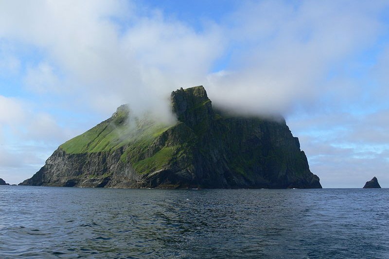
 Soay, one of the islands of the St. Kilda archipelago
Source: https://en.wikipedia.org/wiki/File:Inselsoay.JPG
Author: Olaf1950

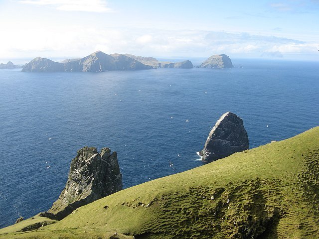
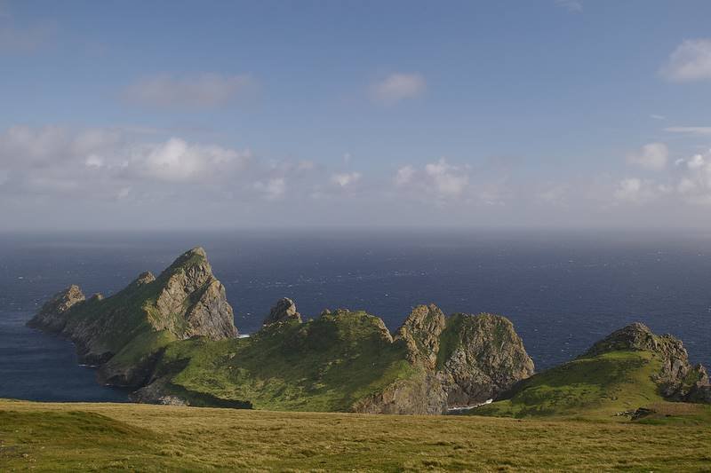
St. Kilda is an isolated archipelago off the coast of Scotland, in the North Atlantic Ocean. It is recognised as a World Heritage Site for both natural and cultural values. St Kilda is some of the westernmost islands of the Outer Hebrides. It comprises a number of islets which are remnants of long-extinct volcano that rose from the seabed. The biggest of these islands is Hirta, which is 670 hectares in area.
Although St. Kilda has been inhabited for the past two thousand years, its population never exceeded 180, and never above a hundred since 1851. Today, the only people who are staying on the islands are military personnel as well as scientists and conservationists.
In addition to natural landscape, St. Kilda has prehistoric ruins as well as medieval villages from the Late Middle Ages. There are for example dry stone huts, called cleit, found at Village Bay.
 Stack Lee in the St Kilda archipelago
Source: https://commons.wikimedia.org/wiki/File:Stack_Lee_from_above_-_geograph.org.uk_-_1440027.jpg
Author: Richard Webb

St. Kilda was inscribed as a World Heritage Site during the 10th session of the World Heritage Committee in Paris, France, on 24 - 28 November, 1986.
World Heritage Site Inscription Details
Location: N 57 49 2 W 8 34 36Inscription Year: 1986
Type: Mixed
Inscription Criteria: III, V, VII, IX, X
 Hirta, the main island of St Kilda
Source: https://commons.wikimedia.org/wiki/File:Hiort2.jpg
Author: Gaelic Arts

 Latest updates on Penang Travel Tips
 Discover with Timothy YouTube Channel
 PG Food Channel
 Learn Penang Hokkien YouTube Channel
 SojiMart Videos
 Share your travels and/or ask a travel-related question
Join the Penang Travel Tips Facebook Group to share photos, tips and anything related to your travels, or ask travel-related questions.
 Map of Roads in Penang
Looking for information on Penang? Use this Map of Roads in Penang to zoom in on information about Penang, brought to you road by road. Discover with Timothy
Let me take you to explore and discover Penang through my series of walking tours on YouTube. You may use these videos as your virtual tour guide. At the beginning of each video, I provide the starting point coordinates which you may key into your GPS, Google Maps or Waze, to be navigated to where I start the walk, and use the video as your virtual tour guide.Disclaimer
Please use the information on this page as guidance only. The author endeavours to update the information on this page from time to time, but regrets any inaccuracies if there be any.Latest from Discover with Timothy: Gurney Bay - what to see and do there
About this website

Hello and thanks for reading this page. My name is Timothy and my hobby is in describing places so that I can share the information with the general public. My website has become the go to site for a lot of people including students, teachers, journalists, etc. whenever they seek information on places, particularly those in Malaysia and Singapore. I have been doing this since 5 January 2003, for over twenty years already. You can read about me at Discover Timothy. By now I have compiled information on thousands of places, mostly in Peninsular Malaysia and Singapore, and I continue to add more almost every day. My goal is to describe every street in every town in Malaysia and Singapore.
Robbie's Roadmap
- Episode 1: Robbie's Journey to Financial Freedom
- Episode 2: Lost in America
- Episode 3: The Value of Money
- Episode 4: The Mentor
- Episode 5: The Thing that Makes Money
- Episode 6: The walk with a Billionaire
- Episode 7: The Financial Freedom Awakening
- Episode 8: Meet Mr Washington
- Episode 9: The Pizzeria Incident
Copyright © 2003-2024 Timothy Tye. All Rights Reserved.